Distance

As the grade becomes a bit more tolerable, you’ll encounter additional large, superb trees, now fractured and uprooted, enabling views across the Illecillewaet Valley that used to be hidden. The modest climb persists up to a small 1-km marker just on the edge of the right side of the path. It took me 28 minutes to reel in this first kilometre, which may give you an indication of the degree of the overall incline of this trail. My average time, with a scrambling pack and over level ground, is 12 minutes per kilometre, or a speed of 5 km/h.
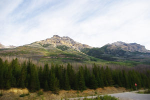
The path now becomes noticeably friendlier. From here on up, the pitch decreases as the trail curves and turns leisurely upward for the next half-hour, with long level stretches that make the climb much more tolerable. At the one-hour mark, the path flattens completely for about 100 m as it roams over a stone walkway, washboards made of logs over bogs, and a small bridge over a stream. The elevation here is 1743 m above sea level, or a gain of about 500 m since the trailhead, with 300 m still to climb to the marked end of the trail. The trees begin to break here, presenting sensational views of the crest up to your right. A path marked viewpoint darts off to the left just ten minutes before this.
Beyond the bridge, the path becomes quite narrow and gnarly with rocks, roots and running water for the balance of the journey. It is really nasty, so watch your step. Of course, the path continues upward, but soon the rewards become apparent. The forest is thinning, trees are becoming stunted and the sky appears larger. Loftier views of rivers, valleys and peaks become more frequent the higher you go.
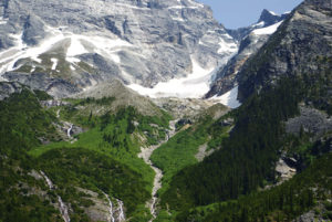
Stepping ever upward becomes easier when you feel a couple of rock staircases beneath your feet about a half-hour into the trek. Vistas of scree slopes, ridges and open alpine will expose themselves as the remaining 100 m of elevation are conquered. The path enters the alpine into a wide, gaping gully that will astound you. Take your time to attain the last stretch of elevation through this trekker’s wonderland. It is simply brilliant.
The trail’s end is 2076 m high, but the truly amazing sites are 45 m higher, beyond the viewpoint marker. Take the extra five minutes to climb this stout slope on the north side of the valley to a lofty ridge. Once you are up on the crest, enjoy a magnificent, easygoing ridge walk that gradually ascends as far as you really want to take it.
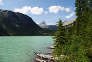
From the ridge there is so much more to see, as there is a clear line of sight straight up and down Rogers Pass, looking north and west. The Illecillewaet Valley, the Hermit Range, the Illecillewaet Névé and Asulkan Brook are only a few of the magnificent treats that are waiting for you. Eagle Peak protrudes from the western horizon, and the peak of Avalanche Mountain stands 2 km to the northwest.
Avalanche Crest history
Avalanche Crest and Avalanche Mountain derive their names from obvious origins. Major Albert Bowman Rogers imparted the name after his party of Shuswap Indians were caught on the west side of the mountain in a snowslide that fell from the appropriately named crest. Rogers made the first ascent of the mountain, in 1881, but his party were not the only ones to share in the wrath of the mountain’s namesake. Two reported encounters with avalanches from the crest include a group in 1908 led by Edward Wheeler, son of A.O. Wheeler, and an ensuing, unnamed ACC party.
Avalanches became such a paramount problem for the CPR that they eventually constructed over a mile of snowsheds below the mountain and crest. Snowfall in Rogers Pass at the time reached staggering depths of up to 12 m. This created a significant challenge for the engineers who designed the route. After all the hard work of getting the rails over the pass, they still had this seemingly insurmountable problem to deal with. The line was closed during the first winter after completion in 1885 to observe the activity and nature of the snowfall and subsequent avalanches. William Van Horne agreed to a massive system of 31 snow sheds, which reached a combined length of 6.5 km.
Avalanches all through the Pass closed the line repeatedly during the ensuing winters and springs, making travel and shipping unreliable, time-consuming and dangerous. Workers and engineers attempted to keep pace using locomotive rotary snowplows and pusher engines as well as brute physical labour with shovels, but regardless, there still remained the ongoing fight against the ceaseless snow.
As the battle continued, trains constantly derailed, lives were lost and repairs and maintenance were continual and expensive. An enormous avalanche on March 4, 1910, killed 58 workers who were clearing the line from a previous slide, thus cementing the decision by the CPR to finally surrender to Rogers Pass and go underground. For the ensuing seven years, the company focused its efforts on building the 9-km Connaught Tunnel, bypassing most of the treacherous avalanches and deep, heavy snow. Unfortunately, this would signal the eventual demise of Glacier House ten years later.
Directions
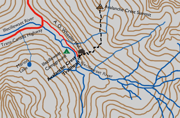
Drive the Trans-Canada Highway 3 km east of the Rogers Pass Centre to Illecillewaet Campground. Turn left to enter the campground area. Once on the paved campground road, drive past the campground on your right to the day parking area. There is a small welcome centre, where you must pay a fee for camping or for a day pass – truly a small price for such superb recreational value. After you have parked and paid, follow the paved road to its transition into a short gravel road. The trail marker is straight ahead.

Gerry Shea
“Gerry Shea moved to Kamloops from Vancouver at the age of nine, which is when he became enchanted by the nearby hills. It was on a family vacation many years later that he discovered the mountains and began hiking and climbing in his spare time, gathering knowledge and experience that he has since used to help beginning hikers, scramblers and backpackers to trek safely. Gerry lives in Kamloops with his wife and children.”Excerpt From: Gerry Shea. “The Aspiring Hiker’s Guide 2: Mountain Treks in British Columbia.” iBooks.