Distance

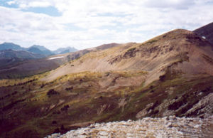
The now-sparse trail wends its way up the grassland to meld into solid limestone. A multitude of trails split off to go into the forest on the left or the open rock on the right. The preference is an individual one, as the forest route offers easier hiking with little elevation loss but poorer viewing. Either way, you eventually find yourself on an open scree patch presenting monotonous toil, as all scree does. This eventually breaks through to rubble at the top of a knoll.
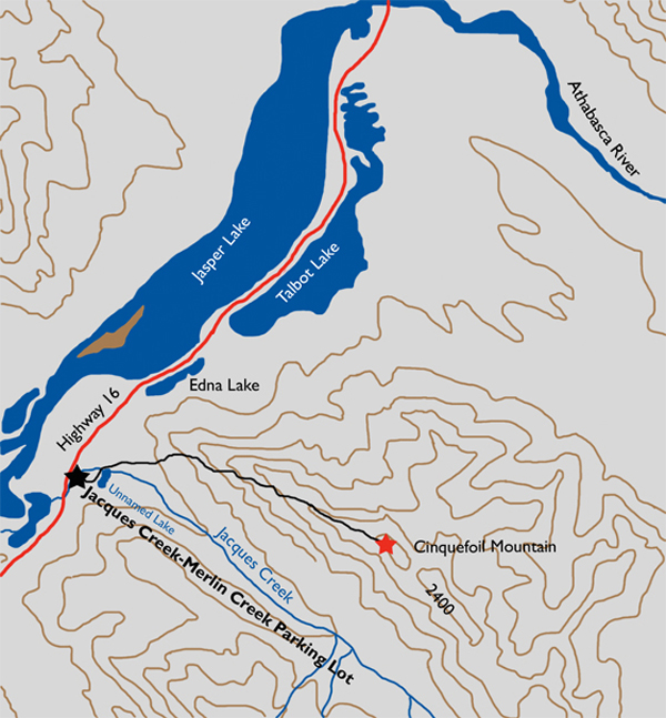
Reaching the summit on this slope will seem to be never ending, as you never really see it until you are almost on top of it. A summit ridge, such as this, is a fantastic opportunity to look around, so try to take your attention away from the summit and truly take advantage of what is being offered up here. The summit will be there for eons, while you may never be back to this place again.
Across the Athabasca Valley looking northwest are Mount Greenock, Gargoyle Mountain and Esplanade Mountain almost due west at true bearing 283º. However, the undeniable attraction from here is the view of the Athabasca Valley with Talbot and Jasper lakes to the north.
History
Mount Cinquefoil was named by Morrison Parsons Bridgland in 1916. The name is derived from the flower, which blooms in abundance in the Rocky Mountains. The five-petalled yellow flowers consist of two assortments: the shrubby cinquefoil and the alpine cinquefoil. The shrubby cinquefoil is in full bloom almost all summer long, from early June to early September. These hardy little plants grow anywhere in any summer conditions in the montane to lower subalpine regions. The alpine version blossoms only in the early summer, from early June to mid-July. It is most commonly found in rocky, windy spots.
Born December 20, 1878, in Toronto, Bridgland graduated with honours from the University of Toronto in 1902. Soon after, he became a qualified Dominion land surveyor, and immediately upon his arrival in the West in 1902 he found himself working for A.O. Wheeler as an assistant.
A substantial aspect of Bridgland’s surveying technique was photo-topography, for which he became widely respected and admired as a pioneer of the method in the mountain West along with Wheeler and the Surveyor-General of Canada of the day, Édouard-Gaston Deville (1849–1924). One of the fundamental facets of the method was to photograph terrain from the highest vantage point in the area being surveyed, so one of the side benefits for Bridgland was that he also became an accomplished mountaineer. He must have become extraordinarily fit as well, given that the work entailed carrying some 35 pounds of equipment up each summit, in addition to the normal climbing gear, which itself was much heavier in those days.
In the off-season, Bridgland would spend his winters in a Calgary office scrutinizing his films in great detail, eventually producing precise topographical maps of the Rockies.
Along with Wheeler, Bridgland became one of the founding members of the Alpine Club of Canada. He mainly organized climbs, but assisted with all outdoor activities for summer camps, keeping meticulous reports of all of these endeavours.
Mount Bridgland in Jasper National Park was named by C.B. Sissons in 1923.
Directions
Drive 26 km east on Highway 16 from the Icefields Parkway traffic lights. There is an unmarked pullover on the south (right) side of the highway where the only amenity is a garbage can. The trailhead is actually the Jacques Creek/Merlin Creek trailhead.