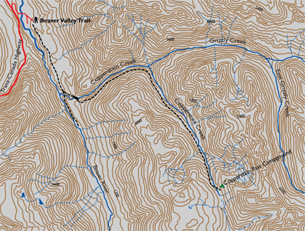
Distance

At 4.8 km the journey reaches a junction that divides the route into two distinct directions. Taking the south (right) fork takes you into the wilderness of the Beaver River Valley, while staying east (left) carries on to your destination. As the trail splits, the sound of the Beaver River gives way to the sounds of the forest. So far, there has been only a mild elevation gain of 152 m.
At the 6-km mark, a right-hand fork leads to an old structure, the Grizzly Cabin, which appears to still be functional. On our last trip here, however, the place was padlocked. We had heard mention of a campground here as well, but we could not find it. The main path stays on the left branch. About 250 m farther on, you cross Grizzly Creek on a suspension bridge. After exploring a small meadow for 10 to 15 minutes, the trail goes back into the forest and begins to climb. Views are limited as you rise from valley to alpine. There are a few breaks in the trees as you cross streams and gullies, but mostly it is an uphill hike on a forest track with frequent switchbacks.
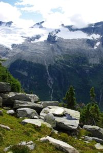
After an hour to an hour and a half of this, the landscape begins to unfold as mountains over to your left become evident. Copperstain Creek trickles in its valley below, also to your left. Continue upward for another 30 to 45 minutes. On the left again, a burn of trees is unmistakable, and Copperstain Mountain is directly ahead to the south as you approach Copperstain Creek Pass.
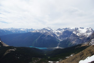
When you arrive at the pass, brace yourself for unimaginable sights. At the far western (right) edge, this massive field unassumingly drops straight down some 1200 m to the bottom of the Beaver River Valley. Across the valley the peaks of Mount Sir Donald, Terminal Peak, Uto Peak and many others reach for the sky. Straight ahead sits Copperstain Mountain and a limitless vision of grass and flowers. It is just such an incredible experience. Simply breathtaking. Enjoy the 2.5-km stroll to the campground nestled in trees on the left slope of the valley. Wooden-plank tent pads are propped to support tents above the moist ground. Ensure you bring sleeping pads, as the wood floor can be quite uncomfortable.
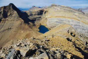
Day hikes are plentiful here. I will leave that up to you. The lodge is not visible from the campsite; it is about 1 km up the valley, high up on the western plateau of the pass.
Directions
Some 11 km east of the Rogers Pass Centre, watch for a large hiking sign directing you to a minor side road on the east flank of the Trans-Canada Highway. The highway sign is marked “Beaver Valley.” The pavement ends, giving way to gravel almost immediately, and begins a wide-sweeping right-hand turn that soon completes 180°. In just less than 1 km, you’ll cross a narrow, single-lane bridge, and about 250 m later meet a fork in the road. Take the left fork, and within another 300 m the large gravel parking lot reveals itself. An outhouse is conveniently located on your right.
The trail begins as a short uphill hike into a forest of thick-based Douglas fir and western cedar spread out between much thinner stands of Engelmann spruce. For the first 4.8 km, the route consists of mild inclines followed by level, park-like stretches, always staying close to the Beaver River. For the first hour, what you hear more often than the river, though, is the sound of the highway. The path is wide and flat, and at sections it becomes interchangeable with a vacated fire road.

Gerry Shea
“Gerry Shea moved to Kamloops from Vancouver at the age of nine, which is when he became enchanted by the nearby hills. It was on a family vacation many years later that he discovered the mountains and began hiking and climbing in his spare time, gathering knowledge and experience that he has since used to help beginning hikers, scramblers and backpackers to trek safely. Gerry lives in Kamloops with his wife and children.”Excerpt From: Gerry Shea. “The Aspiring Hiker’s Guide 2: Mountain Treks in British Columbia.” iBooks.