Distance
Rising steam obscures the gently sloping rocks, which are draped in multicoloured algae in shades of bright orange, white, green, grey and black. Sharp-edged calcium formations and the faint smell of sulphur characterize the hot springs. Please stay off the area of the rock slope: tufa mounds and algae pools are rare habitat for several plant species and are a very sensitive ecosystem.
BC Parks is trying to restore previous damage to the land around the hot springs and parks staff asks visitors to limit their use and follow the signage. To reduce present degradation and minimize future damage, the trail to the bathing pool is now more defined. It heads uphill and around to the right of the tufa mounds.
The forest along the trail is primarily Englemann spruce and subalpine fir. Several large avalanche paths drape the slopes, offering the occasional view at the surrounding landscape. Grizzly bears and other large mammals frequently use the lower elevations near the trail.
The trail to the hot springs crosses many wet, wide and very muddy sections, and the route is much harder than I would expect given the distance and elevation gain. Small creeks spread out across the heavily trodden, deep, black soil. Heavy horse and hiker use has further deepened the saturated muck into gumbo thick slop.
Bathing in the hot springs
Coming right out of the ground, the water is scalding hot and too hot to bathe in. Icy Dewar Creek water must be added to the small bathing pool. Signs are posted to a designated trail directing hikers how to reach the slimy sulphur-smelling pool. Hikers are asked to please stay on the trails.
Camping
Camping is not permitted near the hot springs, but Bugle Basin is a suitable campsite 500 m north, farther along the trail. From the hot springs the trail contours around the top of the tufa mounds and is defined. There are no services and few facilities in this remote park and BC Parks request that campers leave no impact and use established fire rings.
The hiker camp is in the middle of huge slide path. It has an outhouse. BC Parks intends to install food lockers in 2009, due to the increased human use and the number of grizzly bears that reside in the area.
The horse camp is across Dewar Creek (west) in the trees at the edge of the slide path. It, too, has an outhouse. When you reach the slide path at Bugle Basin, follow the trail across Dewar Creek and head up the left side of the basin for 500 m on a trail. This heads into a hidden meadow to the established horse camp. BC Parks requests that horse campers not camp on the east side of Dewar Creek.
We stripped off our clothes, sodden from a day hike in rain and snow, and slid into the calming pools to soak the trail memories away. Snowflakes melted on our bare shoulders, the sound of the rushing creek nearby softened our weary minds and a warm serenity crept up our tired limbs. We soaked until the water wrinkled our fingers and not a trace of cold lingered in our bodies.
The hardest part of the day hike was not the hike in, but getting out of the comforting hot water. We squished into our cold wet clothes and faced the long muddy hike out.
The trailhead is well-marked at N26000-E38300 with a registration box. Take the left fork to the hot springs where a sturdy bridge spans the turbulent Wesley Creek.
7 km: The trail appears to head across the creek, but don’t cross it. Instead, turn right along the east bank of the creek and follow the bushy side trail that cuts higher on the eastern bench above the creek.
9 km: Intersect again with the horse trail.
10 km: Take the left fork on the well-used trail. The final kilometre of the trail steepens as you hike beside the turbulent creek in a tightly banked gully.
11 km: Dewar Creek Hot Springs, at 1680 m (5,500 ft.).
St. Mary’s Alpine Provincial Park
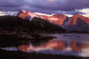
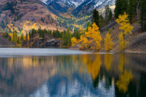
St. Mary’s Alpine is a weathered land of sparkling lakes, stark tundra and subalpine forest, predominantly larch and fir. Expansive bouldered slopes of ancient Purcell granite tumble over most of the park and many of these huge blocks of broken bedrock are car-sized. These boulder fields often lie either on very steep slopes or under a mask of lichen.
The park is wilderness and no trails lace the backcountry. Hikers into this region must be experienced in bushwhacking, routefinding and wilderness travel. Exploring the park offers days of good hiking, where you can climb between the lakes on various plateau levels. Twenty lakes sparkle against the talus and numerous mountain peaks separate the sky. Bleak Lake may still hold the remnants of a tiny glacier.
There are no facilities in the park and it is too remote for cell-phone access. Plan on several days of hiking and camping in this park.
Maps
Topographical maps, 1:50,000 series edition 3, featuring 100-ft. contour changes, are adequate for most hikes and most routefinding. St. Mary’s Alpine is too fractured for normal map and compass routefinding. A gentle slope indicated on the map as a potential route is often a series of cliffs. The cliffs may not be big enough to alter the contour lines, but they certainly influence travel. More detailed, black and white, 1:20,000-scale topo maps may be more useful in this wilderness park. They are available from map vendors in Cranbrook. Use 1:20,000 scale 82F.099 and 82F.089.
Park status
Neighbour to Purcell Wilderness Conservancy to the north, St. Mary’s Alpine Provincial Park adds another protected wilderness to the Purcell Mountains. The 9164-ha park lies at the headwaters of the St. Mary River and was set aside as a Class A park in 1973.
Directions
For detailed road directions see St. Mary River earlier in this chapter.

Janice Strong
Janice Strong is an established professional outdoor photographer. Her images grace collections all over the world and appear in many respected publications. She is passionate about hiking and is also an avid snowshoer and skier, exploring the outdoors of the East Kootenay in southeastern BC year round.She openly shares her passion for the outdoors with others and has introduced hundreds of people to the joys of hiking. For a decade she led hikes for the City of Cranbrook – Parks and Recreation. With her guidance, many people have themselves become enthusiastic hikers.
Climbing mountains, finding new places and enjoying the experience of the journey have always been important to Janice. She cherishes the little things she sees along the trail, as well as the grand destinations.
When Janice is not writing, hiking or taking photographs, she is involved in various creative digital, website design or photographic projects for her clients. She and her husband, Jamie Levine, enjoy their rural property, near Cranbrook, BC.


