Distance

The first 800 m of this journey is on a broad cat track. Along this stretch of trail, the view across the north side of the valley (over your right shoulder) consists of a spectacular sheer limestone wall that allows waterfalls to plummet several hundred metres to the cliff base. Look slightly more to the east (farther over your right shoulder) to catch a glimpse of Mount Bourgeau (2926 m).
The trail branches to the right off the cat track at 800 m and descends into the Healy Creek Valley; this fork is well marked with signage. The trail descends for a short distance until it reaches a small bridge that crosses the leisurely moving Sunshine Creek. On close examination of this narrow stream, aquatic mosses such as Scouleria aquatica can be seen.
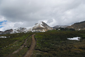
From here the trail ascends slowly through a forest of Engelmann spruce and alpine fir. Feathermoss, false azalea and wintergreen inhabit this lovely valley. At 3.1 km the trail crosses Healy Creek to its north bank. The headwaters of this cold, clear stream are only 6–7 km upstream in the alpine ponds at Healy Pass. At 5.5 km you will come upon the Healy Creek campground. This is a valuable resting spot as it contains the only outhouse in the entire valley. Just before reaching this campground, search for the remnants of the foundation of a log cabin along the side of the trail used by John Gerome Healy. This area was explored by him after his arrival in the Rockies in search of precious metals. From the Simpson Pass junction at kilometre 5.9 the trail climbs somewhat more severely but only in spurts. At 7.7 km up the trail you will cross Healy Creek again where the forest opens up into rolling hills of alpine flower meadows. As you ascend farther up into the alpine, the scenery becomes proportionately more stunning. Please stay on the trail to avoid trampling these delicate species of flowers. Alpine anemone, contorted lousewort, bistort, alpine paintbrush and pink heather dominate this lush meadow.
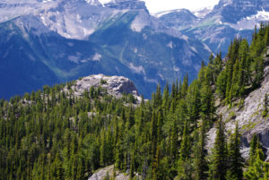
From the summit of Healy Pass, at 9.2 km (2328 m), looking westward, you’ll see Whistling Valley below, with Scarab Lake draining into Egypt Lake across the valley. The Pharaoh Peaks are to the northwest (right), with the Ball Range behind that. Twenty-nine kilometres to the southeast at a bearing of 149º true is the unmistakable horn of Mount Assiniboine.
The trail now drops 333 m over the course of the 3.3 km to Pharaoh Creek and the Egypt Lake campground. At the bottom of the descent are a Parks patrol cabin and a junction in the trail. Keep straight on the trail, with the patrol cabin on the right and the Redearth Trail on the left. Crossing Pharaoh Creek here will lead directly to the Egypt Lake campground. The overnight hut at the campground is regulated by Parks Canada and can be reserved ahead of time.
History
The area you are in, Healy Creek and Healy Pass, were named by George M. Dawson in 1884 after Captain John Gerome Healy. In the early 1880s Healy, along with companion J.S. Dennis, decided to try their luck at mining and staking claims in this region, including Healy Creek and Pass, Copper Mountain and Silver City.
Prior to his arrival in the Rockies in search of copper and silver, Healy assisted with the construction of two whisky-running operations, Forts Whoop-up and Hamilton, near present-day Lethbridge, Alberta, in 1869. Prior to that, they had been driven out of Montana for having done the same thing at Fort Benton.
The forts were used to trade cheap whisky to the Natives for thousands of buffalo hides and hundreds of thousands of wolf and fox hides, which were sold at a huge profit. The first of the two Canadian forts was burned down by the Cree in an attempt to save their people from alcoholism, starvation and disease. Shortly after Fort Hamilton was destroyed, a stronger fortification, Fort Whoop-up, was built only a few hundred feet away. This whisky trade was quite possibly the singular reason for the near extinction of the buffalo in Western Canada. In May 1873 the North-West Mounted Police was formed to bring order to a lawless land, and the whisky forts were eventually shut down.
Healy left the Rockies and ventured to the Yukon Territory to join in the Klondike gold rush. He convinced several prominent Chicago families to invest in starting the North American Trading & Transportation Company in Dawson City. The company supplied transportation and supplies to the thousands of prospective millionaires, maintaining a fleet of steamships and supply stores. They were very active in trading furs and gold as well. The company was a huge success and Healy died a very wealthy man.
The naming of Egypt Lake comes from the theme of the surrounding geographical landmarks. The Topographical Survey of Canada came up with these monikers in the early 1900s. The outline of Scarab Lake apparently resembles a beetle, and therefore it was named after the sacred beetle of ancient Egypt. The narrow south section of Mummy Lake should remind you of a mummy’s legs and feet, while the entire north portion of the lake is the body and head. Interestingly, the Pharaoh Peaks looked a lot like a row of Egyptian mummies to someone, while Pharaoh Lake speaks for itself with the northwest end appearing like a crowned Pharaoh’s head. All of these natural features are in the same vicinity. Regardless of the nomenclature, they are all worth seeing, and the trip should be planned for when the flowers are in full bloom.
Directions
Eight kilometres west of Banff, take the Sunshine Village exit off Highway 1. Travel this picturesque road for 9 km until it reaches the Sunshine Village parking lot. The trailhead is marked at the west end of the gondola terminal.