Distance
This short and easy hike to Lower Elk Lake could be either a great introductory backpacking trip or an access to other trails in the park.
Accommodation in Elk Lakes Provincial Park
Lodge
The trail passes a lodge/ranger station that is staffed by BC Parks during the summer. Accommodation is also available for public rental. This modern lodge, operated by the Alpine Club of Canada, is reached by a short hike (500 m) from the main trailhead at Elk River FS Road on a wide level trail. See Contact Information and References or www.alpineclubofcanada.ca/facility/reservations.html for information.
Camping
Lower Elk Lake Campsite is an easy, beginner-level, walk-in campsite. The picturesque and popular site is by the lakeshore, in mature forest. The hike in takes about 30 minutes from the trailhead and park entrance at Elk River FS Road. Facilities include fire rings, a cable food cache and pit toilets.
Pétain Campground is a new site about 6 km from the trailhead and about 1.5 km from the south end of Upper Elk Lake. The camp is beside the trail to Pétain Waterfalls. (The former campsite washed out when the creek flooded in 2003.) Facilities include a bear-proof storage locker, a cooking area, campsites and a pit toilet.
If arriving at night after the long drive, there is a flat spot just inside the park entrance that is suitable for a tent. No water, no facilities.
Further explorations
I did not write details for every hike. Most of the Elk Lakes Park trails are of such good quality and so well marked that I am only mentioning my favourites.
Upper Elk Lake
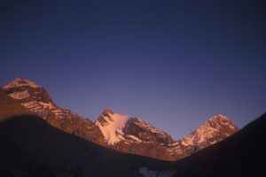
This is the largest and most scenic of the park’s lakes. Follow the signed trail west from Lower Elk Lake for 1.5 km. The trail crosses the Elk River bridge in the forest. The lake is about 2 km long and the trail follows the shore, with views of vertical layers of rock forming the base of rugged limestone mountains. The lakeside trail has recently been upgraded.
Viewpoint Trail
About halfway along the shore of Upper Elk Lake, the spur trail to the viewpoint branches left (south). This 1.5-km hike climbs 91 m (300 ft.) through a forest to an east-facing view of the rippled limestone of the Elk Range. There are no edge railings along the narrow rocky bluff.
Pétain Waterfalls
Tall, powerful and impressive, the Pétain Waterfalls are worth the hike. The surge of the cascade is captivating as the water crashes over a cliff below Mount Castelnau. Remnants of the Castelnau Glacier hang in white curtains high above falls. The cone-shaped summits flank the glacier, Mount McCuaig on the left, Mount Castelnau to the right.
On a hot day it is refreshing to stand right at the base of the falls, on the rocks beside the turbulent cascade, with blasts of shattered water droplets cooling you.
Upper Pétain Basin from waterfalls
High above the Pétain Waterfalls is an alpine basin on smooth bedrock below the glaciers. The trail leaves from the right of the Pétain Waterfall trail. As soon as you can see the falls, look for a faint trail heading uphill into the forest. This hike is not well-maintained and may not be signed. The trail gains a lot of elevation from the waterfalls to the basin lower rim. Once in the open, gradually sloping Pétain Basin, you can explore the high tundra for many hours. The bedrock slopes climb another 600 m (2,000 ft.) and the Pétain Glacier, Mount Pétain and Mount Castelnau rise high above the basin. It is a challenging but rewarding hike.
Lower Elk Lake to Frozen Lake Loop
This nice day hike on well-made trails is a scenic and moderate loop with a diversity of sights and topographies. The hike features fine views of Lower Elk Lake from a high slope, and at Frozen Lake the views of Mount Fox are impressive. This is a good day hike that features much of the park’s northern vistas.
0 km: Trailhead at park entrance from Elk River FS Road. Ranger-station/lodge 500 m along the trail.
1.5 km: Lower Elk Lake campsite by the shore of Lower Elk Lake.
Stay on the trail to around lakeshore and follow the signs for Upper Elk Lake.
Upper Elk Lake
Distance: 3.3 km to north end of Upper Elk Lake
Elevation gain: nominal
Pétain Waterfalls
Distance: 7.5 km from park entrance to waterfalls (2.5 km from the Pétain campground)
Time: short day hike
Rating: easy
Elevation gain: 152 m (500 ft.) from trailhead
Base of falls: 180 m (6,000 ft.)
Trail to Upper Elk Lake and Pétain Waterfalls
0 km: Trailhead at park entrance.
1.5 km: Lower Elk Lake campsite. Stay on the trail to Upper Elk Lake.
3.3 km: For Upper Elk Lake, follow the shoreline trail for 2.5 km. The trail heads south from the end of the lake through marshy meadows, with boardwalks in places.
7.5 km: Waterfalls. The trail continues across the meadow toward the cascade and ends at the river.
Upper Pétain Basin from waterfalls
Time: day hike
Rating: strenuous
Distance: 10.5 from trailhead (7.5 to Pétain Waterfalls plus 3 km to Upper Pétain Basin)
Elevation gain: 520 m (1,700 ft.)
Basin lower rim: 2315 m (7,600 ft.)
Trail: steep, brushy trail that may require scrambling and is neither well-defined nor maintained. It is a strenuous steep climb in forest, to alpine basin below the glaciers.
Lower Elk Lake to Frozen Lake Loop
Distance: 15.2 km loop
Time: day hike
Rating: moderate; well-signed
Trail: good BC Parks trails
Elevation gain: 480 m (1,580 ft.) to Frozen Lake
Frozen Lake: 2170 m (7,115 ft.)
Trail
0 km: Trailhead at park entrance on the Elk River FS Road. Ranger-station/lodge 500 m along the trail.
1.5 km: Lower Elk Lake Campsite. Stay on the trail to Upper Elk Lake.
3.3 km: Upper Elk Lake (northern end). Cross the bridge over the Elk River and follow the signs north on the Fox Lake trail. The trail gains elevation steadily in forest.
5.3 km: Fox Lake is a shallow tarn. Continue north.
6.1 km: West Elk Pass. Follow the signed trail 1.7 km (west) to Frozen Lake, with additional gain of 213 m (700 ft.).
8.2 km: Frozen Lake, a scenic and deep subalpine lake below a cirque of Mount Fox.
10.4 km: Return on the same trail to West Elk Pass and continue hiking east in forest to Elk Pass (200 m or so).
10.6 km: At Elk Pass you may either go 7 km north to Peter Lougheed Provincial Park (Kananaskis) trailhead in Alberta or return to the BC trailhead at the park entrance by following the trail south in forest and across high meadows with views of the stark limestone Elk Range.
14.8 km: Turn left (east) and hike 200 m to the ranger station/lodge.
15.2 km: Return to the BC Parks trailhead on the Elk River FS Road.
Directions
Road: sturdy car; very dusty in summer; washboards and rough
Follow the directions to Elk Lakes Provincial Park.

Janice Strong
Janice Strong is an established professional outdoor photographer. Her images grace collections all over the world and appear in many respected publications. She is passionate about hiking and is also an avid snowshoer and skier, exploring the outdoors of the East Kootenay in southeastern BC year round.She openly shares her passion for the outdoors with others and has introduced hundreds of people to the joys of hiking. For a decade she led hikes for the City of Cranbrook – Parks and Recreation. With her guidance, many people have themselves become enthusiastic hikers.
Climbing mountains, finding new places and enjoying the experience of the journey have always been important to Janice. She cherishes the little things she sees along the trail, as well as the grand destinations.
When Janice is not writing, hiking or taking photographs, she is involved in various creative digital, website design or photographic projects for her clients. She and her husband, Jamie Levine, enjoy their rural property, near Cranbrook, BC.


