Distance

The way is easy from here, as there really isn’t any other place to go; this is the only trail you will come across on this hike.
The route is a steady, skyward ascent that is quite gradual. Overall, the elevation gain is accomplished with a combination of flats, dips and rises, so there aren’t any straight-up heart-pounding stretches.
About a half hour (2 km) into the hike, a barrier with a sign prohibiting travel on the main trail confronts you. This is the first of many such barriers and signs along the trail. The alternative routes are obvious, and in this case there is a diversion that drops down to the right. The major monument at this juncture is a large crucifix that was carved by the villagers of Oberammergau, Germany.
For another half hour or so the forest becomes increasingly deciduous. It is a subtle change, but as the path progresses, the forest changes, only to eventually be reclaimed by the darkness of cedars and hemlocks.
At the 3 km mark, an amazing lookout point is evident as the trail opens up to a rock outcropping where the forest is behind you. Here, you have achieved 324 of the 721 m in height gain.
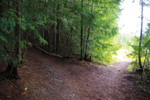
A good half hour from the lookout, the path rounds a corner turning left that perches you on top of a wide, thinned forest that is sparse enough to tolerate substantial grassy undergrowth. Although the trail continues to gain moderate elevation, it is negligible compared to what you have accomplished to this point.
The path makes its way through the uncluttered trees for 5 to 10 minutes before approaching a superb lookout. This rocky outcropping offers spectacular north and south panoramas of Pleasant Valley.
Beyond this lookout the grade gradually rises, making the 20- to 30-minute exertion to the summit a well-earned prize.
The landscapes from the viewpoint are wide and varied. Mountains, rivers, valleys, farmland and small villages are all in sight.
Directions
From Vernon, travel north on Highway 97A for about 36 km to the village of Enderby. In the middle of town, turn right onto Cliff Rd. and drive 2 km to Brash Allen Rd. Within 1.4 km the road turns to gravel, but the parking lot is just another 1.5 km down Brash–Allen Rd. From the highway, the route is clearly marked all the way with blue Provincial Park signs directing you to Enderby Cliffs Protected Area.