Distance
The steep slopes of the Lizard Range and the high Rockies limestone mammoths rise just west of the city: the Three Sisters, Mount Bisaro, Mount Fernie, Mount Hosmer and Mount Proctor are an impressive barrier. On the east side of the river, the mountains are rounded forested summits.
The lower slopes of all the Fernie mountains are perfect for trail building. The bases of these slopes are moderately steep and the ground in the forest is often stony clay or gravel.
Fernie volunteers and public donations helped build a huge network of trails around the city. If you want steep mountain riding or gentle rides around town, Fernie trails are built for a variety of skills and abilities.
The Fernie Trails & Ski Touring Club
See www.fernietrails.com, Contact Information and References. For Cabin Ridge Trail, for contact information and for more on Thunder Meadows Hut reservations and membership in this active club (Fernie bike trails information by PG.) see Contact Information and References
The Fernie Trails & Ski Touring Club sent the following:
We have trail stewardship agreements with BC Crown Lands, BC Parks and Tembec to build and maintain non-motorized recreational trails in the Fernie area for both hiking and mountain biking. We also continue to represent non-motorized backcountry recreation at the Southern Rocky Mountain Land Use Table.
Maps
Detailed topographical trail maps of the Fernie bike trails are available at Fernie retail stores. The Fernie Trails & Ski Touring Club has produced two versions of the Fernie Trail Guide maps, as well as the latest Fernie Mountain Bike Map. The trails are rated for difficulty and marked as single track, double track and whether rideable uphill or downhill. Sales from these maps are used to maintain the hiking and mountain biking trails the club has built in the past 15 years.
Some examples of the trails are:
The Fernie Alpine Resort ski hill, which maintains a great diversity of bike trails from extreme to moderate. The resort asks that hikers watch out for speeding mountain bikes zipping down the slopes.
The Fernie Trails & Ski Touring Club, which has built many high-quality bike trails east of the Elk River, north of Coal Creek Road.
There are also good quality and fun bike trails in Mount Fernie Provincial Park.
Mount Fernie Provincial Park
Mount Fernie Provincial Park is a small, forested, RV campground (where BC Parks reservations are accepted), and there is a picnic area.
Castle Rocks
The Fernie Trails & Ski Touring Club’s newest trail is Castle Rocks. This mountain bike trail heads to a viewpoint overlooking Fernie, the Elk Valley and Three Sisters Mountain from a high vantage on the summit of Castle Mountain.

Elk River walk
For a scenic, short and easy family walk/ride, follow the bank of the Elk River. The best mountain views are just upriver from the north bridge, heading northeast toward Sparwood. There you can enjoy both the mountain views and the tumbling chatter of the Elk River.
The river’s light-blue, glacier-fed water flows down from the rugged limestone mountains of the upper Elk Valley, and the river slows its descent when it reaches the wide flat valley near the city of Fernie.
The trail is atop an earth levee in the forest. If you hike into Fernie it is a suburban walk. Yet just upriver from the city the character of the walk changes and the Elk River trail becomes a picturesque, relaxing and semi-wild path. Enjoy the impressive views of rugged, light-grey Mount Hosmer, which stands by itself to the north. Mount Proctor and Three Sisters Mountain form the famous skyline of this Rocky Mountain city.
Begin from the parking lots by the north Elk River bridge and follow the river. The first 2 km of the trail are the best. It is scenic and semi-isolated as it winds between the river and the forest.
Maps: 82G/11 Fernie (NAD27); 82G/6 Elko (NAD27); 82G/7 Flathead Ridge (NAD27); 82G/10 Crowsnest (NAD27)
Road map
Trailheads from Mount Fernie Park
Take Highway 3 to 2 km south of the South Elk River bridge in Fernie. Turn west off the highway at the sign for Island Lake Resort and Mount Fernie Provincial Park. (The junction is north of the Fernie Alpine Resort turnoff.)
0 km: Turnoff Highway 3 on a signed paved road and the provincial park boundary is about 0.5 km.
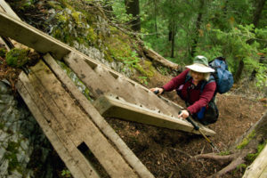
800 m: At the first road left (south) when you enter the campground, turn in to the picnic area and park. Hike or cycle 100 m southwest to the bridge across Lizard Creek that links trails from the provincial park up to the Fernie Alpine Resort. More bike trails leave from the northeast side of the campground (behind the service building) and sprawl eastward up the lowest slopes of Mount Proctor to the power line. The road through the campground continues, on good gravel, past the park to Island Lake Resort.
Fernie/Elk River Walk
Rating: very easy hike or bike
Time: very short hike
Distance: 2 km
Elevation gain: nominal
Trail: follows the banks of the Elk River; gravel trail by riverbank
Road map
Road: any vehicle; Highway 3
Drive
Highway 3 to Fernie. Two bridges cross the Elk River in Fernie: one north, the other south.
Fernie Area Map
Hikes: Elk River Walk, Fairy Creek Falls, Ghost Rider on Mount Hosmer, Three Sisters Mountain, Mountain Lakes Trail
Directions
Turn off Highway 3 onto 4th Street (by south Fernie bridge) and up to the main business area (Victoria or 2nd Avenue). Cross the CPR tracks, turn right onto Pine Avenue, past the Aquatic Centre, and turn left onto Coal Creek Road. Follow this road for 2 km, then turn right onto River Road and cross Coal Creek Bridge. Climb on this road for 2.8 km and park on the very wide turnaround (road descends after this). This is the trailhead for Castle Mountain hiking trails and the Roots and Hyperventilation biking trails. The club will be installing signage on all these trails in 2009.

Janice Strong
Janice Strong is an established professional outdoor photographer. Her images grace collections all over the world and appear in many respected publications. She is passionate about hiking and is also an avid snowshoer and skier, exploring the outdoors of the East Kootenay in southeastern BC year round.She openly shares her passion for the outdoors with others and has introduced hundreds of people to the joys of hiking. For a decade she led hikes for the City of Cranbrook – Parks and Recreation. With her guidance, many people have themselves become enthusiastic hikers.
Climbing mountains, finding new places and enjoying the experience of the journey have always been important to Janice. She cherishes the little things she sees along the trail, as well as the grand destinations.
When Janice is not writing, hiking or taking photographs, she is involved in various creative digital, website design or photographic projects for her clients. She and her husband, Jamie Levine, enjoy their rural property, near Cranbrook, BC.