Distance
A locally famous shadow perpetuates the legend of the Ghost Rider. The shadow appears on the south side of Mount Hosmer in the evening light of midsummer on the cliffs high above the city. The Ghost Rider shadow resembles a horse and rider with someone walking beside the horse.
The legend arose after the prospector William Fernie came to the Elk River valley. Apparently, Fernie saw the daughter of the chief of the local Native people wearing beads of coal. He demanded the people show him where they found the valuable substance. They agreed to show him only if he promised to marry the chief’s daughter. Yet after obtaining access to the coal source, Fernie refused to marry the woman.
The Natives avenged the fraud and put a curse on the valley. The curse was supposedly responsible for the floods, fires and coal-mining disasters that have since haunted the city of Fernie.
When the sun declines in the western sky, the shadow of the Ghost Rider reminds people of the power of a promise and the strength of a betrayal.
Since the curse was decreed on Fernie, the city has had fires, floods and disasters. The worst was in August 1908, when a forest fire almost destroyed the city. The city was rebuilt with expensive brick and stone instead of common wood, and today Fernie is proud of its dozens of beautiful heritage brick buildings.
In 1964 the chief of the Kootenai Nation performed a ceremony to lift the curse, and today Fernie is a growing recreational and tourist centre for the southern BC Rockies.
Hike
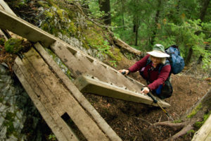
The Ghost Rider trail is an enjoyable day hike for most hikers. It is a good steep hike up the south side of Mount Hosmer to the ridge overlooking the cliffs where the Ghost Rider shadow appears. The trail is in good condition, except when wet. Then, it is extremely slick and muddy.
The best part of the hike is from the pass through sparse forest and meadows to the wide ridge and overlook. The overlook features views of Fernie and the Elk Valley sprawling out to the south. On the western skyline rise Three Sisters Mountain and Mount Bisaro. From the ridge overlook, the trail continues to Ghost Rider summit at 2316 m (7,600 ft.).
Half the trail is in dense forest and the upper sections are through meadows, with small, steep portions of open alpine rubble. Occasional clumps of wildflowers dot the open slopes with colour. Arnica, Indian paintbrush and the purple silky phacelia are common summertime flowers along the trail.
Ghost Rider summit is just a ripple along the south ridge of the stark and jagged Mount Hosmer, which rises to 2500 m (8,221 ft.). Climbing Mount Hosmer is a much more rugged hike. It is rocky rough route and most hikers don’t go beyond the summit of Ghost Rider trail.

0 km: The dirt path quickly gains elevation through an avalanche path of lush vegetation and into a mixed forest of pine, spruce and fir. Some trail junctions are not well-marked.
1.6 km: Crossing a minor washout is precarious in wet conditions. Stay to the main trail by taking the next two left forks.
1.7 km: In less than 200 m is a switchback. The main trail turns right uphill at the switchback (avoid going straight on a tiny trail into the forest). The rest of the trail is obvious, bending south and traversing several avalanche paths. It gains and loses elevation a couple of times. Just below the pass the trail ascends in a series of tight steep switchbacks through the alpine rubble. The switchbacks span only about 30 m (100 feet) before they turn repeatedly in hairpin curves up the last pitch to the pass on Ghost Rider.
3.5 km: Ghost Rider Pass, N96800-E42100, at 1994 m (6,544 ft.). From the pass hike southeast on a good trail to the overlook along the ridge.
4 km: The overlook. The trail continues upward about a kilometre, gaining 240 m (800 ft.) to the summit.
5 km: Ghost Rider summit, N95986-E43046, at 2316 m (7,600 ft.).
Directions
Road: 2-wheel drive, but 4x4 helps for traction; steep, often muddy
See Hartley Lake and Dicken Road earlier in this chapter for details of Hartley Lake Road.
0 km: Hartley Lake Road junction with Dicken Road, N90400-E43300. Stay on the main road, just wider than one lane.
6.6 km: Trailhead and parking for Ghost Rider–Mount Hosmer; unsigned, well-worn trail right (east) side into the bush at a wide pullout on a left curve, N95894-E41363, at 1443 m (4,730 ft.). (There are several similar left curves along here; check distance or GPS; only one has a well-worn trail from it.)

Janice Strong
Janice Strong is an established professional outdoor photographer. Her images grace collections all over the world and appear in many respected publications. She is passionate about hiking and is also an avid snowshoer and skier, exploring the outdoors of the East Kootenay in southeastern BC year round.She openly shares her passion for the outdoors with others and has introduced hundreds of people to the joys of hiking. For a decade she led hikes for the City of Cranbrook – Parks and Recreation. With her guidance, many people have themselves become enthusiastic hikers.
Climbing mountains, finding new places and enjoying the experience of the journey have always been important to Janice. She cherishes the little things she sees along the trail, as well as the grand destinations.
When Janice is not writing, hiking or taking photographs, she is involved in various creative digital, website design or photographic projects for her clients. She and her husband, Jamie Levine, enjoy their rural property, near Cranbrook, BC.