Distance
The massive project was begun in 1905, and $423,000 later it was completed in 1914. Not only was the endless supply of water from highland lakes used for fruit farming, there was demand from ranchers as well. The highly successful canal was used until it was shut down in 1970 as more modern methods of irrigation came into use.
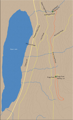
The canal trail is segmented, as only portions of it have been retained as hiking/biking trails. The section detailed in this chapter is a 10 km partial loop, with the trailhead at the northernmost point of the Grey Canal Trail system at Glenhayes Rd. It crosses McLennan Rd. and Rugg Rd. along its path.
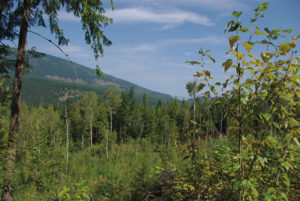
Even though this section of trail is within city limits, I chose this portion because it is more removed from the city, and the farther south the trail travels, the denser the urbanization becomes. An additional factor with this choice of section of the trail is that it simply presents the most magnificent views of Swan Lake, Pleasant Valley and the City of Vernon. As the trail approaches newly developed subdivisions, its dependence on paved roads intensifies and the views diminish as the elevation drops.

Pass through a narrow gate and immediately drop into the V-shaped canal, emerging after a few minutes to parallel the canal on your left. Suddenly the view opens up.
As you look to the west, Swan Lake and the Bella Vista Hills dominate the landscape. Views of Pleasant Valley can be observed to the north and they become even more sprawling as you travel farther south.
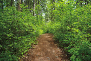
As the path travels beside the canal, it dodges in and out of small pockets of forest that probably have sprouted directly from the effects of the canal’s payload over the years.
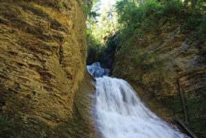
With over a kilometre gained, the first signs of the canal’s remains become evident. Wooden trestles, cement foundations, concrete transfer stations and galvanized troughs litter the landscape. It is beautiful to see what is left of this wondrous man-made creation. Interpretive signs are appropriately placed along the pathway.
Forty minutes into the trek, the path navigates another narrow gate and crosses McLennan Rd. to emerge onto Grey Canal Rd. Stay on this paved road for about 10 minutes to the end of the road.
The route gets back onto the trail after it passes through another narrow gate. You will notice there is progressively more development as you cover more ground walking south.
Some 3.5 km from the trailhead, you come to the Rugg Rd. access. This large gravel parking lot has two trails leaving it, one on either side. The trail on the left goes steeply upward, higher into the hills, while the lower one, to the right, sticks to the canal. Good news: take the low trail on the right.
Roughly 1.5 km of drifting on this scenic trail brings you to a prominent junction. Taking the right fork would bring you to the intersection of Silver Star Rd. and Blackcomb Way. Take the left route instead and briefly climb uphill to a parking lot.
The trail leaves the parking lot from the far side. This trail loops back to the Rugg Rd. parking lot, closing a loop as it rejoins the parking lot. This is the same trail that exits the left side of the Rugg Rd. parking lot going steeply uphill.
After a little over a kilometre, this flat upper trail briefly drops, bringing you back to the Rugg Rd. parking lot.
From here, return to the Glenhayes Rd. parking lot on the same route that brought you here.
Directions
Travelling north from Vernon on Highway 97, turn right onto Elmwood Rd. At a T-junction at the top of Elmwood Rd. (about 200 m), turn right onto Pleasant Valley Rd. and then immediately take a wide left turn to get onto L & A Rd. Drive on L & A Rd. for about 1 km to where L & A Rd. becomes Baker–Hogg Rd. Continue along Baker–Hogg Rd. for 800 m and turn right on Glenhayes Rd. The parking lot is marked on the left side of the road, 600 m up Glenhayes Rd.