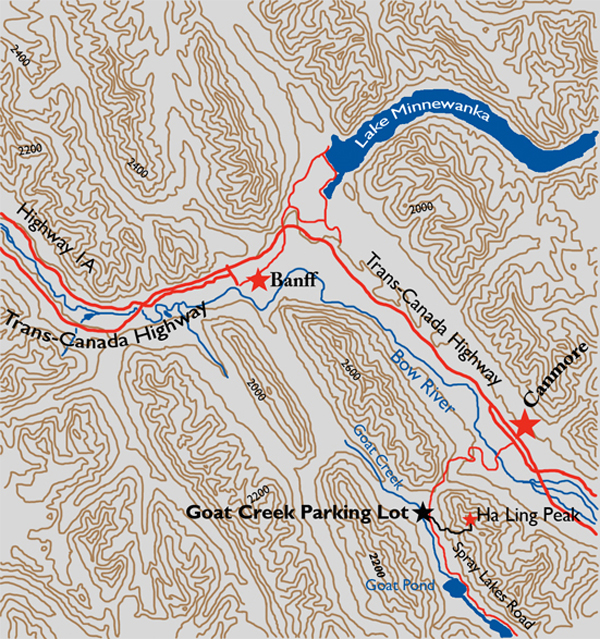
Distance

There are a couple of small avalanche slopes that open the forest for views, but for the most part this is a journey through an evergreen forest. A little over an hour into the hike will place you at treeline, having accomplished 292 m of elevation, with 516 m remaining. Another hour of long meandering switchbacks brings the trail to a junction at the col between Ha Ling Peak and Mount Lawrence Grassi. Take the left trail, heading north, and continue along this path up the slope of rock.
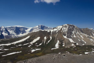
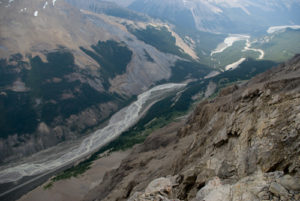
Thirty minutes from the col will place you at the summit. The path toward the summit comes precariously close to the south edge of Ha Ling Peak and presents some incredible stomach churning while doing so. There is so much to see from up here. Looking to the northwest is the southeast end of Mount Rundle. Toward the southwest lies the Goat Range, and to the northwest, the Fairholme Range.
History
Ha Ling Peak was named after a Chinese cook, though it is unclear whether he worked for the CPR or a local mine. Either way, in 1896 Ha Ling bet his co-workers $50 that he could summit the peak and return within ten hours. Not only did he accomplish this within the allotted time, he did it in barely half the time and was back by noon for lunch. His co-workers did not witness this accomplishment and with a $50 bet on the line, they did not believe him, either. Luckily, Ha Ling had planted a flag on summit as evidence of his feat, so he led a party to the summit to see the flag and to affix a much larger one in its place that was seen from the town of Canmore. Unofficially named “Chinaman’s Peak” at the time, in his “honour,” this did not become its official title until 1980. This name did not last long, however, as public pressure got it changed to Ha Ling Peak in 1997. Prior to all of this, the mountain was called “The Beehive.”
Directions
Whether driving east or west on the Trans-Canada Highway outside of Canmore, simply follow the signs to the Nordic Centre. The directions will take you right through the middle of downtown. Drive past the Nordic Centre on Spray Lakes Road for 1 km. The road turns to gravel and an additional 4.2 km will bring you to the Goat Creek parking lot.