Distance

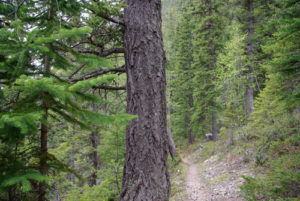
The trail into the forest narrows where an old, rough-looking sign guides you to Helmet/Ochre Creek, Tumbling Creek and Helmet Falls campgrounds. A stairway of railway ties assists your entrance into the woods. Within another five minutes, a sign steers you to stay straight on the path and you’ll feel a mild elevation gain. A couple of small streams are crossed as the journey through forest of spruce and pine levels off. At about the 3.5-km mark, you’ll cross a magnificent avalanche slope of shrubs, wild berries and flowers.
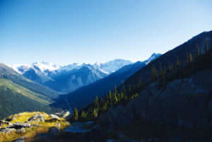
After crossing the slope, the route pierces the forest for another six to eight minutes, coming across signs in a small, cleared intersection 3.9 km from the trailhead. Helmet Creek Falls Campground is another 11.1 km straight up the main path. As the hike departs the junction it begins a slight uphill climb and the forest becomes sparser with thicker trees. Two kilometres from the intersection, the route opens up to a small field of red paintbrushes, yellow and purple daisies and a variety of grasses. There are great views of north and west peaks from this engaging little field.
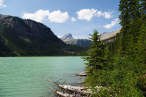
The next ten minutes of the hike takes the trail down to the river bottom, where tributaries joining Ochre Creek make for some minor rockhopping. Helmet/Ochre Creek Campground is situated on the far bank of Ochre Creek. From here, 8.8 km remain to Helmet Creek Campground. Stroll through the campground as the route continues along the eastern shoreline of Helmet Creek and crosses it over a sturdy bridge. The path leaves the riverbank to climb a series of switchbacks for about 500 m. For the next 3 km, up here, the journey continues through avalanche slopes and a rolling forest with views of Helmet Creek far below. Eventually you drop down to the river again, skirting it for about 2 km and crossing it over another suspension bridge.
Leaving the river and entering the forest brings a welcome silence for a short time. Within the next 1.5 km the first glimpse of Helmet Falls will grab your attention. This site really caught us by surprise during our first hike to the campground. It is still far away from here, but is incredibly spectacular. The falls are 352 m high, seem to fall forever and are backdropped by a massive limestone wall. Amazing. The trek finishes on a fairly level circuit of trees and meadow and finally descends over a bridge into the campground, after passing a Parks Canada warden cabin.
Directions
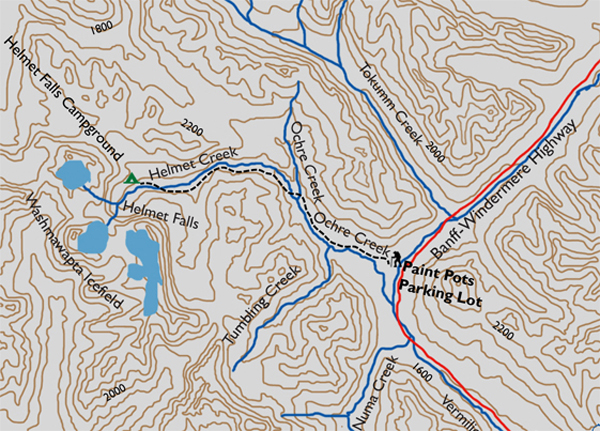
From Castle Junction, drive south on the Banff–Windermere Highway (Hwy. 93) for 19.6 km to the Paint Pots parking lot, on the west side of the highway. The trailhead is well marked, at the edge of the forest on the west side of the parking lot.
The route leaves the parking lot quite uneventfully. A straight, level path even accommodates wheelchair access within the first minute, diverting to the left of the main route. Both paths descend gently, converging shortly before crossing the Vermilion River by way of a short suspension bridge. On the other side of the river, the astounding 360° panoramas include peaks of the Vermilion Range dominating the west and northwest horizon while the Ball Range towers against the eastern sky. If you can tear yourself away from this engrossing encounter, follow the track along the stream and into the forest to arrive at the lower Paint Pots. This should take no longer than ten minutes.

Gerry Shea
“Gerry Shea moved to Kamloops from Vancouver at the age of nine, which is when he became enchanted by the nearby hills. It was on a family vacation many years later that he discovered the mountains and began hiking and climbing in his spare time, gathering knowledge and experience that he has since used to help beginning hikers, scramblers and backpackers to trek safely. Gerry lives in Kamloops with his wife and children.”Excerpt From: Gerry Shea. “The Aspiring Hiker’s Guide 2: Mountain Treks in British Columbia.” iBooks.