Distance

At about the 3.5-km mark, you’ll see a magnificent avalanche slope of shrubs, wild flowers and grasses. We saw a bear. Of the thousands – yes, thousands – of kilometres I have trekked, I have only had one single bear encounter. Actually, this was, um, barely an encounter at all. More of a happenstance. And the bear wasn’t even aware we were having an encounter. We had my golden retriever, Summer, along and were about to walk out onto the above-mentioned grassy slope, but we’d stopped, as we usually do before entering such slopes, to check for bears. And sure enough, this time there was one, on the slope to the uphill side of the trail. It was too busy eating berries to realize we were there, or maybe was aware of us but just didn’t care. We backed into the forest, returned to the trailhead and called it a day.
The lesson learned was to keep your dog on a leash when walking the backcountry trails. I know definitively that if Summer hadn’t been leashed, she would have been exploring at least 50 m ahead of us. She would have trotted right onto that slope, torn after the bear, and then hightailed it back toward us with the bear in hot pursuit. So although restraining your dog in the wilderness may seem like a ridiculous rule, it is an essential one. Oh, and pick up your dog’s poo, too.
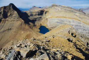
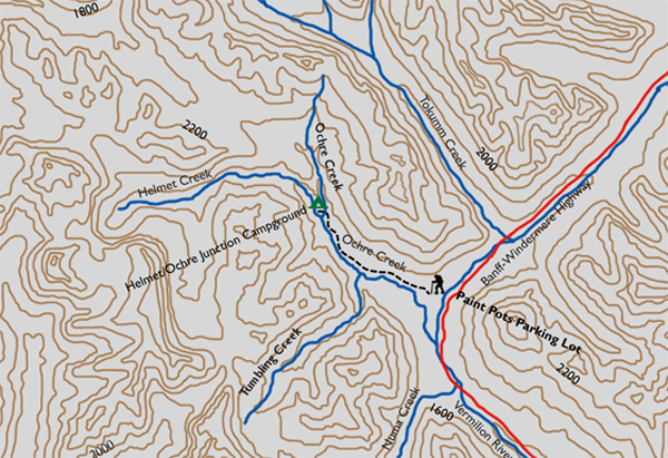
After you’ve crossed this slope, it re-enters the forest for another six to eight minutes before reaching an intersection in a small clearing. This signed junction marks the 3.9-km mark of the hike. The Helmet/Ochre Junction campground is another 2.6 km straight up the main route. As the trail departs the junction it begins to climb slightly and the forest becomes sparser with thicker trees. Two kilometres from the intersection, the path opens up to a small field of red paintbrushes, yellow and purple daisies and a variety of grasses. There are great views of peaks to the north and west from the engaging little field.
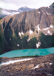
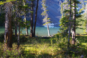
The last ten minutes of the hike take the path down to the river, where tributaries joining Ochre Creek make for some minor rockhopping. The campground is situated on a premier spot if you enjoy the continual sound of rushing whitewater.
Directions
The route leaves the parking lot uneventfully. A straight, level path accommodates wheelchair access within the first minute. Both trails descend gently to the Vermilion River to cross a short suspension bridge. At this position, the 360° panoramas are astounding. Peaks of the Vermilion Range dominate the west and northwest horizon, while the Ball Range towers in the eastern sky. If you can stop looking around long enough, follow the track along the stream and into the forest to arrive at the lower Paint Pots. This should take no longer than ten minutes.
The muddy path inclines slightly to gain the upper aspect of the Paint Pots. At the top of the ochre beds, the path becomes indiscernible, but it does pick up again at the far end after crossing the outlet of one of the cones. The cones are formed from the iron oxide buildup at the outlet of cold mineral springs. They rise in height from the constant deposit of minerals at the base of the cone.

Gerry Shea
“Gerry Shea moved to Kamloops from Vancouver at the age of nine, which is when he became enchanted by the nearby hills. It was on a family vacation many years later that he discovered the mountains and began hiking and climbing in his spare time, gathering knowledge and experience that he has since used to help beginning hikers, scramblers and backpackers to trek safely. Gerry lives in Kamloops with his wife and children.”Excerpt From: Gerry Shea. “The Aspiring Hiker’s Guide 2: Mountain Treks in British Columbia.” iBooks.