Distance

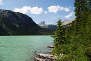
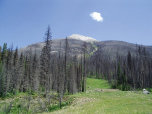
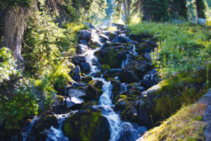
The journey takes you through several meadows, crosses a stream, rises onto a boardwalk, heads back into a forest of Engelmann spruce and then opens up to a series of wide, steep rockslide slopes over the next 2 km. The views afforded by the exposed rockslides are absolutely amazing panoramas of the Selkirks to the north and the Monashees to the west. Looking northeast, mounts Coursier and Dickey are among many amazing sights as you wander through the upper subalpine. The hike is so effortless, and presents such diversity, that a small hint of guilt seems to linger.
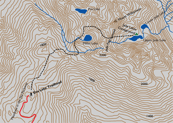
Although these trails are in a Canadian national park, they still have remnants of the imperial system of measurement. Just after the first hour of hiking, for example, you’ll come upon a three-mile marker. With 4.8 km behind you, the previously flat, easy hike soon reminds you that you are in the mountains, with a short, five-minute burst of switchbacks. Signage at the summit of the switchbacks marks a branching of the route, to the right to Jade Lakes and left to Eva Lake. The fork and sign are at the 5.6-km mark.
Directions
On the east edge of the outskirts of Revelstoke, BC, the Meadows in the Sky Parkway exits the Trans-Canada Highway and begins its upward journey toward the wondrous Mount Revelstoke backcountry. Stop at the kiosk at the entrance to the Skyway to pay your fee, and then drive ever upward, winding around switchbacks on a smooth, paved road. Park in the spacious lot and make your way to the trailhead either on foot or by free shuttle bus. Look across the pavement to the northeast to find the marked trailhead.
The journey begins with a brief, slow drop in altitude right away and continues for about 500 m. Remember that you have driven 26 km and reached the summit of Mount Revelstoke, so the vistas up here are already enormous.

Gerry Shea
“Gerry Shea moved to Kamloops from Vancouver at the age of nine, which is when he became enchanted by the nearby hills. It was on a family vacation many years later that he discovered the mountains and began hiking and climbing in his spare time, gathering knowledge and experience that he has since used to help beginning hikers, scramblers and backpackers to trek safely. Gerry lives in Kamloops with his wife and children.”Excerpt From: Gerry Shea. “The Aspiring Hiker’s Guide 2: Mountain Treks in British Columbia.” iBooks.