Distance

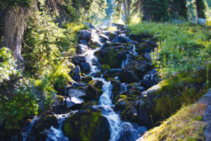
Approximately 1.4 km farther along, the short, 400-m side trail leading to Lake Duchesnay is another easy detour. From this intersection, the level path crosses over the Little Yoho River into Laughing Falls Campground just a few short minutes later.
Carry on through the campground to a signed intersection at the far north end. Take the left turn upward to Little Yoho Campground and the Alpine Club of Canada’s Stanley Mitchell Hut. Settle in, physically and mentally, for a long haul of constant switchbacks lasting for about a half-hour. Not much else to mention here other than switchbacks: no views, no waterfalls, no glaciers, no tarns, not even a bear. Just switchbacks. You will know when you are close to the end of the agony when you approach a broken-down boardwalk. Be careful, as there are exposed spike heads, and the aged boards are quite slippery.
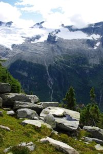
Just up the way there is a junction and the summit of the switchbacks. Good going. Turn left toward Little Yoho Campground and to another sign saying it’s 3.5 km to the campground. The redundancy of signs continues 100 m later directing you to the right with 3.4 km remaining. Although the switchbacks are behind you, the hike continues to climb at a steady, moderate rate. Another kilometre gained and the trees open up in a short clearing exposing towering mountain peaks. But this is just the beginning of the remarkably diverse beauty of the Little Yoho Valley. You are near the end of the trail. As the route levels off, the Little Yoho River runs beside it and the way becomes increasingly open, revealing more spectacular views, including the Iceline to your left (west).
A streamside walk over tributaries and clearings suddenly erupts into the massive meadow and the “community” of Little Yoho. The surroundings will astound you. The Stanley Mitchell Hut is on your immediate right, the warden cabin is to the far left and the campground is directly ahead. This is one of the busiest remote regions in the Canadian Rocky Mountain national park system. The ACC hut can accommodate 26 trekkers, and the campground has ten campsites.
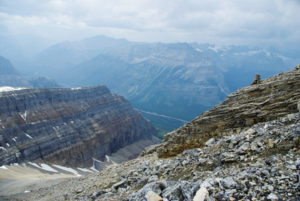
Day hikes include scrambling mounts Kerr and Pollinger; reaching the highest named lake in Canada, Kiwetinok; exploring the Iceline Trail; and backtracking to Twin Falls. It is no wonder that the translation of the Cree word Yoho is “place of wonder.” Other renditions might include amazing, awesome and beautiful. This piece of Earth is all of these and more.
Directions
From the Yoho Information Centre in Field, BC, drive 3.7 km east on the Trans-Canada Highway and turn left onto Yoho Valley Road. The parking area for the trailhead is 13 km in, at the Takakkaw Falls parking lot, with the Yoho Valley Trail beginning its journey at the far end of the parking lot. Only five minutes into the hike, just 400 m from the parking lot, you’ll come to Takakkaw Falls Campground. The Yoho Valley trailhead is situated at the far end of the campground.

Gerry Shea
“Gerry Shea moved to Kamloops from Vancouver at the age of nine, which is when he became enchanted by the nearby hills. It was on a family vacation many years later that he discovered the mountains and began hiking and climbing in his spare time, gathering knowledge and experience that he has since used to help beginning hikers, scramblers and backpackers to trek safely. Gerry lives in Kamloops with his wife and children.”Excerpt From: Gerry Shea. “The Aspiring Hiker’s Guide 2: Mountain Treks in British Columbia.” iBooks.