Distance

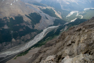
Not soon after you’ve enjoyed the quiet of the forest, Mosquito Creek begins to speak to you, announcing its presence slightly farther up the trail. The trail breaks through the woods, opening into an expanse featuring the rapidly moving yet shallow Mosquito Creek, making it an archetypical “babbling brook.” Just as impressive is the astounding visual impact of the stunning mountains and ridges all around the valley.
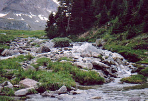
Many feeder streams are crossed while tracking Mosquito Creek, and some of the crossings are made of narrow, although flattened, logs. Extreme caution is advised while walking on these logs in wet conditions. As well, protective rain gear should be worn after a rainfall in a valley such as this, as the moisture from the low, wet foliage will inevitably fall onto pants and boots.
Enjoy the scenery here, because the forest reclaims the trail when it enters Mosquito Creek Campground. The campground offers few luxuries, but even so, a bear pole and outhouse are welcome necessities. There are picnic tables beside the creek, a central cooking and eating area and truly abysmal tent sites.
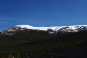
The only day trip is to venture farther up the trail beyond the campground. Highlights of the trail begin with an alpine stroll above treeline, the small Mosquito Lake, 2.4 km from the campground, North Molar Pass and the upper and lower Fish lakes. There is a campground at Upper Fish Lake. The length of the day trip depends entirely on what you want to see and how high you wish to climb, as the elevation increase from the campground to North Molar Pass is about 600 m over 5.1 km. Lower Fish Lake, the farther of the two, drops 365 m from the summit of North Molar Pass, placing it 9.3 km from Mosquito Creek Campground.
History
Mosquito Creek received official title on May 7, 1959, even though this name had already been used locally for the better part of a century. The derivation of the name is obvious, but it is unknown exactly when it was chosen or who was the first person to be swarmed by mosquitoes in the valley. One thing is certain: there are mosquitoes here. Even during a hike in moderate rains, the little monsters still managed to plague us.
The name Molar Pass comes from Molar Mountain in the same area and received its official status on January 21, 1985. In 1859 James Hector decided that the mountain was tooth-shaped, thus naming it Molar Mountain. The pass was used infrequently as a connecting route from the Pipestone Pass to the Bow Valley.
Directions
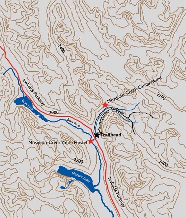
At the intersection of the Icefields Parkway and the Trans-Canada Highway, drive north on the parkway for 25 km. Pull into the Mosquito Creek Youth Hostel south of the Mosquito Creek Bridge on the west side of the highway, and park in the designated area for hikers. The trailhead is across the parkway, on the north side of the bridge.