Distance
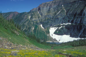
Hike through grassy wildflower meadows with a great diversity of species including glacial lilies, lupine, mariposa lilies, penstemon and asters. Spruce and fir forests grow in some sections along the ridge.
The Mount Thompson Rim trail is great for beginner hikers, families and people who want an scenic view hike and be able to drive all the way to the ridge, but remember it is a very rough steep road to drive. In addition, there are a couple of short sections that involve easy scrambling. Note that water is not available along this route.

0 km: Begin the hike by the north communication towers from the Mount Thompson Forest Service Recreation Site. The recreation site has an outhouse and picnic tables. Hike the trail along the ridge walk heading south.
1.5 km: From the trailhead, across an open meadow, the trail has an indistinct fork. Take the right fork up the crest of the ridge. This is the only place along the trail that may require attention. If you don’t see the fork and you follow the well-worn trail along the eastern bank of the open grassy ridge, you will soon notice that the trail disappears in another 500 m into a flattened pass (2 km from the trailhead). The main Mount Thompson Rim trail is just uphill to your right (west).
5.3 km: Climb up a rocky section, round a corner and arrive at the south communication tower, a very strange looking device, indeed. This tower, at 2130 m (7,000 ft.), marks the end of the ridge. Backtrack to the north tower and the vehicles.
Directions
Road: challenging to drive: very steep, rough and rocky; ATV access or high-clearance 4x4 vehicle
Road climbs steadily from Creston to the communication tower on Mount Thompson, gaining 1410 m (4,700 ft.).
0 km: Highway 3 east of Creston, turn off south (at a fruit stand) onto Canyon/Lister Road.
1.1 km: Turn left (east) at Whimster Road.
1.8 km: Continue straight past houses onto Mount Thompson FS Road.
2.6 km: Continue straight (avoid the left fork of Mount Thompson/Lipsett FS Road, sometimes not signed).
3.4 km: Turn left at a switchback. Avoid the right fork onto the Erickson Watershed road, at 680 m (2,220 ft.).
5.5 km: Turn right at the first of many tight steep switchbacks. There are white rock cliffs on the uphill side.
10 km: Take left fork uphill, signed Mount Thompson Lookout (hard to see the sign).
12.2 km: Turn right uphill and drive on the right side of the communication towers. Park at the forestry lookout and BC Forest Service trailhead sign (just past the towers).

Janice Strong
Janice Strong is an established professional outdoor photographer. Her images grace collections all over the world and appear in many respected publications. She is passionate about hiking and is also an avid snowshoer and skier, exploring the outdoors of the East Kootenay in southeastern BC year round.She openly shares her passion for the outdoors with others and has introduced hundreds of people to the joys of hiking. For a decade she led hikes for the City of Cranbrook – Parks and Recreation. With her guidance, many people have themselves become enthusiastic hikers.
Climbing mountains, finding new places and enjoying the experience of the journey have always been important to Janice. She cherishes the little things she sees along the trail, as well as the grand destinations.
When Janice is not writing, hiking or taking photographs, she is involved in various creative digital, website design or photographic projects for her clients. She and her husband, Jamie Levine, enjoy their rural property, near Cranbrook, BC.