Distance

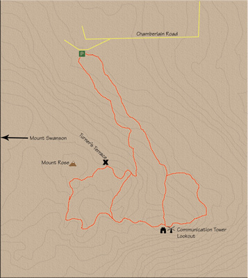
The road will plateau at this point as it comes to the first of a few junctions. Both the left and right branches are clearly marked here: left for Mount Rose, right for Mount Swanson. Both of these designations are slightly misleading, however, since the trail to Mount Rose actually takes you to a communication tower on the southwest flank of Mount Rose, while the Mount Swanson choice leads slightly to the west of Mount Rose. The entire route can be somewhat confusing, but if you do not concern yourself with where you are, and simply follow the trails, you will enjoy an incredible journey with magnificent views.
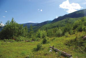
So, turn right following the Mount Swanson sign and walk this wonderful 2.5 km loop that hooks up with the Mount Rose trail, taking you to the same communication tower. Within a few minutes, you will arrive at a terrace marked as “Turner’s Terrace.” As the trail progresses, the sights become increasingly spectacular. The trail undulates, dipping into a couple of small valleys. At about 1.6 km from the Mounts Swanson and Rose intersection, you will come across a lesser trail going to the left. Stay straight and carry on to the tower about 800 to 900 m farther.
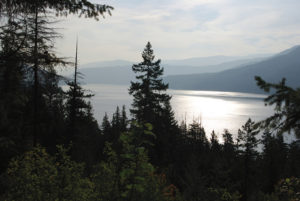
From the tower lookout, there might not be a better view of Pleasant Valley anywhere. Otter Lake is the first visible body of water, and beyond that is Swan Lake on the left and Okanagan Lake on the right.
Return to the trail and walk past the tower to find a narrow single-track trail that heads into the forest. Enjoy the scenery up top, because although the remaining 2.5 km downhill walk in the woods is very pleasant, it leaves all of the best sights behind.
Directions
From Vernon drive north for about 23 km on Highway 97 to the village of Armstrong. As you enter the outskirts of the village, turn left onto Rosedale Ave. Drive down Rosedale for approximately 1.6 km to where it intersects with Pleasant Valley Rd. Turn right on Pleasant Valley Rd. and continue along it for a little over a kilometre. At Bridge St., turn left, and because Bridge St. is short you will almost immediately turn left onto Wood Ave. Stay on Wood Ave. for about 1.5 km, and where it makes a sharp right turn it becomes Salmon River Rd. Salmon River Rd. soon makes a sharp 90° left turn, followed by a sharp right. About 1 km from the sharp right, you will meet Hallum Rd. on the left. Turn left onto Hallum Rd. and drive about 2 km to Chamberlain Rd. Turn left onto Chamberlain Road and follow it for roughly 1.75 km. When you come to a fork where Chamberlain Rd. continues to the right, take the left fork to find the trailhead parking lot 500 m up this fork, on the left side of the road. The trailhead is at the far (west) end of the parking lot. There is another trail at the near end of the lot, but this is the exit of the loop and it is where you will finish the trek. The trail is an old gravel road that begins to climb immediately. Take note of the detailed signboard illustrating the trail grid.