Distance

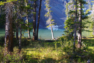
The campground occupies both banks of a feeder stream that helps fill the waters of Numa Creek. There are bear lockboxes, outhouses, eating areas and campsites on both sites, establishing quite a unique setup. Metal bear boxes replace traditional bear poles due to the increased frequency of Ursus horribilis traffic in the area. Numa Creek rushes in from the south and the tributary joins it just south of the campground.
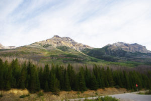
Day trips beyond the campground include Numa Pass, Tumbling Pass and Floe Lake. All of these side trips constitute significant elevation gain, with moderate distances. The Rockwall Trail is just 430 m beyond the campground. Numa Pass is 7.4 km south of the intersection, climbing 833 m from Numa Creek Campground, and Floe Lake is 2.6 km from the pass. The route to Floe Lake drops by 348 m. By contrast, Tumbling Pass, 5.3 km north of the intersection, has an elevation gain of 719 m. Either venture is worthy of the effort but quite exhausting. Or you could just sit in the campground and listen to the streams.
Directions
Some 24 km south of Castle Junction, the Numa Falls roadside picnic area is easily located on the west side of the Banff–Windermere Highway (Hwy. 93). Parking is plentiful. Find the trail at the south end of the lot or follow the sound of the falls.
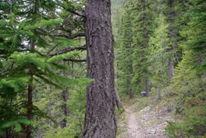
The expedition begins at the parking lot with a bridge crossing over the Vermilion River and the spectacular Numa Falls. The bridge appears to be reinforced to handle parking lot adventure seekers, as it is made of thick, solid steel. Weave your way through the tourists to burst onto the path and immediately turn left. Switchbacks begin almost right away, lasting for about 10 to 15 minutes before levelling off.
A kilometre of mindless stroll through a forest filled with Engelmann spruce is broken with a small high bridge over a dry gulch. A short-lived climb turns into a level crossing through an overgrown avalanche slope that shortly proceeds back downward. Numa Creek is below on the right side, and the sudden descent quickly brings you to the riverside, and eventually to another metal bridge at the 3-km mark. The flat path continues to stick to the river, crossing many feeder streams, for about 2 km, but will eventually begin a short climb again.


Gerry Shea
“Gerry Shea moved to Kamloops from Vancouver at the age of nine, which is when he became enchanted by the nearby hills. It was on a family vacation many years later that he discovered the mountains and began hiking and climbing in his spare time, gathering knowledge and experience that he has since used to help beginning hikers, scramblers and backpackers to trek safely. Gerry lives in Kamloops with his wife and children.”Excerpt From: Gerry Shea. “The Aspiring Hiker’s Guide 2: Mountain Treks in British Columbia.” iBooks.