Distance

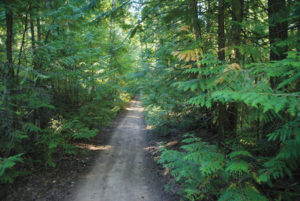
A few more green arrows keep you on the path while you stroll through this peaceful forest. A pattern of weaving and rolling up and down through small shallow gullies becomes repetitive. About 3 km (40–45 minutes) from the trailhead, however, the route widens to a grass road once again. Almost five minutes later, you will notice the first of two grassed-over roads approaching from the left.
The first road is unmarked, but the second one, a few minutes on, has a marker on a tree pointing the way to Damer Lake. Turn left and head up this road. Although at the time of writing there was not a marker indicating that Oyama Lookout is up this road, it certainly is. From this junction you can see a noteworthy gravel road just ahead – if you end up on this, you have gone too far.
Now, about 15–20 m up the road you just turned onto, a green sign, low to the ground, steers you off the road, to the right and into the bush. As you approach this sign, bend over and take a close look at it, because it has a handwritten message that says 5 M FARTHER. So, go 5 m farther and take the trail upward into the bush. This very brief diversion plants you onto another inactive dirt and grass road. Turn left and the road follows a power line that supplies the tower at the summit of Oyama Lookout. A few minutes up this road, take note of signage for Damer Lake lookout, on the right.
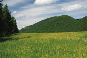
Around the 4 km mark, or one hour into the hike, the trail passes under the power line as it enters a large clearing. At the far end of the clearing, make your way to another green arrow marker, which will send you down a road that exits the left end of the clearing. The power line is off to your left.
Within five minutes the trail opens to another clearing and the power line joins the journey again. Once more a green arrow at the far end of the clearing sends you to the left. This time, you are departing the main road as you begin to climb. The tower comes into view.
The balance of the journey is an uphill section that will take about 10–15 minutes, depending on your level of fitness. Near the end of the trek, the trail crosses a service road. You either sprint or gasp your way to the summit. Your choice.
Directions
From Vernon, drive roughly 16 km south on Highway 97 to Oyama. Turn left on Oyama Rd. as it splits the waters of Wood and Kalamalka Lakes. Drive for 1.7 km to Middle Bench Rd. Turn right on Middle Bench Rd. Almost immediately, turn left onto Todd Rd. Less than a kilometre up Todd Rd., turn right onto Oyama Lake Rd. Signs to Oyama Lake Resort will have directed you this far as well.
Oyama Lake Rd. instantly becomes a gravel road. Drive 9.2 km on the gravel and turn left. The route to Oyama Lake Resort continues to the right. One kilometre farther on, take another left, and about 400 m up the road you’ll see a parking area in a grassy pullout.