Distance

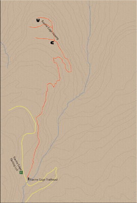
2. The trail is easy to follow, as an abundance of green arrows leave little doubt of where it travels. Less than a kilometre into the hike, the trail’s namesake begins to take form as it approaches the edge of a ravine. This is the first of many viewpoints on this trek.
3. The trail traverses a large cutblock as it follows the ridgeline. A few feeder trails are picked up on the main trail, so keep your eye on the green arrow markers to ensure the correct route. The trail then descends steeply but briefly a couple of times as it ventures away from and then back to the ravine’s edge.
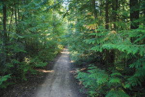
About 2 km, or 30 to 35 minutes, into this hike, there is a significant unmarked junction. The trail is inland from the edge, travelling toward it, with a cutblock on the left. A well-trodden path approaches from the cutblock to join the main trail. This side trail appears to be more travelled than the one you are currently on, but stay straight and follow the trail as it drops down through a thick forest. There is substantial overgrowth crossing the narrow trail, but this only lasts a couple of minutes.
Very soon, the path makes a sharp 90° left turn after it has wrapped around the right side of a large-diameter conifer.
You should now be at the edge of a very steep ravine.
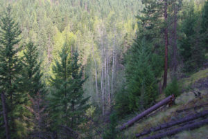
Follow the undulating trail as it accompanies the ridge on your right. Gradually it makes its way downward. You will see a boulder field quite a distance below you off your right shoulder. The trail descends farther downward on steep switchbacks through a dank forest, eventually reaching the massive rock field. This drop to the boulder field should take about 10 minutes.
A few minutes beyond the rubble, the trail meets the ravine once again. The path follows the edge of the ravine, taking a couple of different turns. Arrows mark the way to the most northern edge, but for the most part it is hiker’s choice. There is an incredible surplus of viewing attainable by finding different vantage points at the edge, so have fun exploring. In particular, Lavington Valley, the village of Coldstream and Kalamalka Lake are the highlights.
Directions
In Vernon, at the major intersection of Highway 97 (32nd St.) and 25th Ave., drive eastward, following the signs for Kalamalka Lake, Lumby, Nelson and Highway 6 South. Turn right onto Highway 6 and travel 8.8 km to King Edward Lake Forest Service Rd. on the right (south) side of the highway. This gravel road was unmarked at the time of writing, so pay attention to your odometer.
Reset your odometer to zero after turning onto King Edward Lake Forest Service Rd., because there are a few junctions to navigate, the first one being at the 4 km mark. Stay on the right-hand road here and continue driving to a junction at the 8.4 km mark. Take the right-hand road here as well. At 8.8 km, take the right-hand road once more. About 500 m later, this road crosses a small creek and you should see the trailhead sign on the right. Drive another 500 m to a large parking area and walk back to the trailhead.