Distance

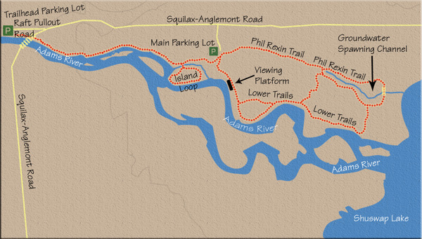
The park’s main parking lot is a few minutes past the island loop bridge.
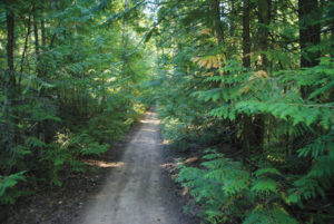
Out in the parking lot, look for the signs labelled LOWER TRAILS, which will take you across to the east side of the lot to Phil Rexin Memorial Trail. This path will regain the forest stroll through cedar, pine and hemlock. This is a walk in a magnificent forest with no sign of a river for 1.5 km until you reach a small bridge that crosses a minor stream.
A few minutes past the bridge, the trail meets a junction. The main loop continues on the left fork, while the right branch will take you to a closer look at the groundwater spawning channel. Another 500 m farther along, the trail encounters another fork; stay left again. Going right will return you to the groundwater spawning channel trail. Staying left at both intersections brings you back to the river and viewing platforms, and eventually takes you back to the main parking lot, completing a 2 km walk from the bridge.
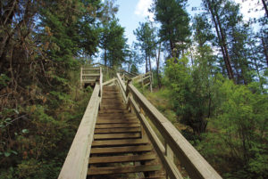
There is a variety of minor side trails, loops and bridges used for watching the spawning salmon in the river, its back eddies and resting pools, but the way is always conspicuous and specified with signage, always directing you back to the main parking lot.
Back at the main parking lot, find your way back from where you came on the trail to the Adams River bridge.
Directions
From the village of Chase, travel east on the Trans-Canada Highway for 10 km to the turnoff for the North Shuswap region. This right-hand exit cloverleafs you onto the Squilax–Anglemont road northbound. Drive this road for 4 km to reach a frontage road call Raft Pullout Rd. Park in the lot at the end of this short service road (one of several parking lots along the length of this riverside provincial park). The trailhead is toward the river, under the bridge.