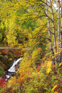
Distance
This open landscape is perfect for enjoying the view across the Elk River to Wigwam Flats, spreading out in a prominent grassy plateau with Mount Broadwood rising in rocky steps. The Elk and Wigwam rivers flow as thin ribbons 400 m (1,300 ft.) below the Sheep Mountain viewpoint. These rivers usually carry different colours of mountain water, depending on what minerals they contain. (For the Wigwam Flats hike, see entry #66.)
The trail up Sheep Mountain follows an old road through Douglas fir forests. In May and early June the grassland near the summit is bright with yellow balsamroot flowers (sunflowers). Unfortunately, springtime on these open, arid, grassy hillsides is also prime season for wood ticks. Take the appropriate precautions for preventing tick bites and enjoy the open scenic views at Sheep Mountain.
Sheep Mountain was used for a fire watch lookout tower, but the structures have been removed. Hikers can also appreciate the extensive views out across the rolling Rocky Mountain Trench, by hiking southwest a little at the upper switchback.

0 km: Hike south along the level road from the gate where you parked, parallel to Highway 93.
1.2 km: Cross the second grassy meadow; look leftward for a small dirt road heading east, N55926-E35935. Follow this small road and in about 100 m it will head into the forest. In a couple of minutes, take the left fork on the older gravel road. The road climbs steadily in switchbacks.
2.9 km: Continue straight (along the right fork).
4.1 km: The road bends left at a switchback, N56964-E37194, at 1140 m (3,740 ft.).
Optional: for a great view to the south and west of the Kootenay River valley and Lake Kookanusa, step off the road and hike straight ahead (approximately southwest) for 400 m in open forest to a grand, low-elevation viewpoint. Return to the road and climb another 1 km, gaining 45 m (150 ft.).
5.3 km: Sheep Mountain summit, N56761-E38081, at 1200 m (3,945 ft.). For views of Wigwam Flats and the rivers, veer right (east) off the path across the open grassland dotted with coarse shrubs for about 100 m. Small bedrock platforms jut out from the sloping grassland above the panoramic view; good picnic spots.
Directions
Road: any vehicle on pavement; high-clearance for 1 km or just walk on a level grassland/road
0 km: At the junction of Highway 3 and 93, 1.2 km west of Elko, turn south on Highway 93.
3.7 km: Turn left (east) off Highway 93, N57914-E35995, on the second large gravel road (300 m south of the Elko Sawmill turnoff).
3.72 km: About 20 m east of the highway, turn right (south) onto a small dirt road.
4.8 km: Drive or walk the small dirt road south about 1 km, staying parallel to the highway. Reach a gate and park, N56853-E35933. Leave the gate as you found it, either open or closed.

Janice Strong
Janice Strong is an established professional outdoor photographer. Her images grace collections all over the world and appear in many respected publications. She is passionate about hiking and is also an avid snowshoer and skier, exploring the outdoors of the East Kootenay in southeastern BC year round.She openly shares her passion for the outdoors with others and has introduced hundreds of people to the joys of hiking. For a decade she led hikes for the City of Cranbrook – Parks and Recreation. With her guidance, many people have themselves become enthusiastic hikers.
Climbing mountains, finding new places and enjoying the experience of the journey have always been important to Janice. She cherishes the little things she sees along the trail, as well as the grand destinations.
When Janice is not writing, hiking or taking photographs, she is involved in various creative digital, website design or photographic projects for her clients. She and her husband, Jamie Levine, enjoy their rural property, near Cranbrook, BC.