Distance

You are at the trailhead in the day use parking area, so your journey can begin as soon as you are ready. Facing the lake, walk on the main road to your left (east). A marker up on a tree in the day use area will indicate you are on trail #8. You want to get to the far southeast end of the lake and enter the surrounding forest. Depending on the water level, there are two roads you can take that wrap around the far end of the lake. It should only take five minutes to walk past the lakeside campsites and enter the forest.
Once in the forest, you’ll encounter a network of roads almost immediately, so pay attention. First, the two roads that bypass the lake intersect. Momentarily you meet another road, with three stacked signs nailed to a tree; fortunately they all exhibit the same singular instruction: OUT. Although #8 trail is marked on a tree looking down the left fork, follow the OUT, OUT, OUT trail to the right, as you eventually want to arrive on trail #10.
Immediately, you approach another junction – take the left fork.
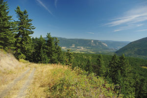
Thirty seconds later, at the intersection with #10 trail, turn left, staying on #10. This is an old, overgrown road, which makes for easy walking. The next 20–25 minutes of the hike is easily navigable and enjoyable. With the exception of a brief incline, the road is flat, wide and open, offering panoramas of Mount Hilliam 4.3 km to the northwest (look left as you walk).
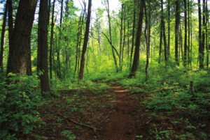
Approximately 2.5 km from the trailhead, the path arrives at a narrow, trickling, soothing creek and a primary gravel forestry road. The #10 trail diverts downhill to the left just before reaching the creek. Walk downward among a mixed forest of cedar, pine and birch, accompanied by the slow-moving creek. Of course, in the Okanagan the level of water in streams like this depends on the amount of runoff that year and how early in the season you are hiking.
Five to 10 minutes down this pleasant path, the #8 trail appears to the left. Take the left turn and follow the #8 trail back to Skimikin Lake.
For the next kilometre, the trail dodges in and out of the forest as it parallels a tall wire fence on your right. Beyond the fence, large fields and tree islands make up the British Columbia Skimikin Seed Orchards.
Eventually the fence ends and the forest takes over. About five to ten minutes beyond the fenceline you will return to the three OUT signs. Turn right and make your way back to the Skimikin day use area.
Directions
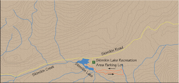
About 14 km west of Salmon Arm, on the Trans-Canada Highway, turn left (south) onto Tappen Valley Rd. Drive 4 km and turn left on Skimikin Rd. Travel 6 km along Skimikin Rd. to find the Skimikin Lake Recreation area off the left side of the road. The way from the highway is clearly marked with signage.