Distance

Once in the forest, you encounter a network of roads almost immediately, so pay attention. Firstly, the two roads that bypass the lake intersect. Momentarily, another road is met with three stacked signs nailed to a tree; fortunately they all exhibit the same singular instruction: OUT. Although the #8 trail is marked on a tree looking down the left branch, follow the OUT, OUT, OUT trail to the right, as you eventually want to arrive on trail #10.
Immediately, you approach another junction – take the left fork.
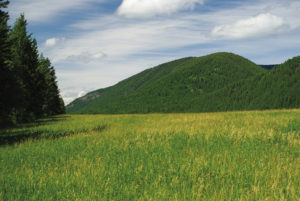
Thirty seconds later, at the intersection with #10 trail, turn left, staying on #10 road. This is an old, overgrown road, which makes for easy walking. The next 20–25 minutes of the hike is easily navigable and enjoyable. With the exception of a brief incline, the road is flat, wide and open, giving panoramas of Mount Hilliam 4.3 km to the northwest (look left as you walk).
Approximately 2.5 km from the trailhead, the path arrives at a narrow, trickling, soothing creek and a primary gravel forestry road. The #10 trail diverts downhill to the left just before reaching the creek.
Cross the stream and turn left to descend down the road for about a kilometre to where the road levels off and takes a sharp left turn. This juncture is well marked with various signs. One is a yellow mileage indicator marked “0 160”; another tells us we are in the Fly Hills snowmobile area; the third warns us we are in a wilderness watch area.
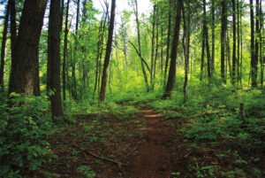
At the apex of the curve in the road, a narrow trail darts off into the trees to the right. Once you’re into the forested trail, a #10 marker is visible on a tree. Follow this trail through a dark forest for about 3 km to reach the winery.
For the most part, the way is clear and marked with small #10 signs. Near the end, however, the trail hits an unmarked junction where one fork continues straight and has a significantly steep upward grade. Take the right fork and within five minutes the path emerges onto a gravel road.
Turn left onto the gravel road and within another five minutes you will arrive at the winery.
Return the same way, but when you reach the gravel road with the three signs, turn right instead of heading back up the road. Some 30 or 40 m along the road you will notice a path leading into the forest on the left (south) side of the road. Once you are in the forest, markers on a tree make it evident that you are on the combined trails #10 and #8. Follow this path through the bush for about five minutes until #8 takes a right turn and #10 continues straight up to the creek crossing. Turn right onto trail #8 to return to Skimikin Lake.
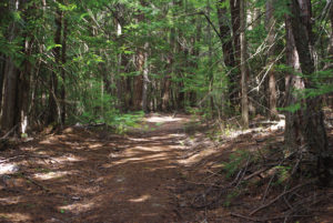
For the next kilometre, the trail dodges in and out of the forest as it parallels a high wire fence on your right. Beyond the fence, large fields and tree islands make up the British Columbia Skimikin Seed Orchards.
Eventually the fence ends and the forest takes over. About five to ten minutes beyond the fenceline you will return to the three OUT signs. Turn right and make your way back to the Skimikin day use area.
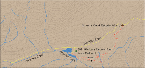
Directions
About 14 km west of Salmon Arm, on the Trans-Canada Highway, turn left (south) onto Tappen Valley Rd. Drive 4 km and turn left on Skimikin Rd. Travel 6 km along Skimikin Rd. to find the Skimikin Lake Recreation area off the left side of the road. The way from the highway is clearly marked with signage. Immediately upon arriving in the recreation area, you will find yourself in a large unpaved parking area. Continue through this lot and pick up the main road at the other end. Carry on for about 400 m to the day use area near the lake. Park anywhere near the picnic tables.