Distance
This is part of the Spray River Loop, which is 12 to 15 km long, going up one side of the Spray River, crossing the river and travelling down the other side. One end is located at the Banff Springs golf course, the other behind the Fairmont Banff Springs Hotel parkade. This route begins at the golf course end of the trail.

Throughout the journey there are two sets of signs, old and new, with identical markers but differing distances. So, from this intersection, turn right and begin trekking either 4.6 or 4.9 km to Campground Sp6. The fire road trail begins to climb now but maintains this mild ascent for only five minutes or so. It then levels off and really does not change much until the approach to the campground. Numerous signs dot the early part of the trail, but regardless, they all steer you to Sp6 along the main fire road. Horses and cyclists share the main route, so it can become mucky in spots, but the surrounding forest of Engelmann spruce, lodgepole pine and standing birch is sparse, permitting off-trail travel around some of the worst spots.
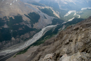
At any time along the way, the view of the Spray River down below is accessible just off the road to the right. Sulphur Mountain and its tram are also visible from the high banks over the Spray River. This short, easy hike will begin a very quick and limited descent about ten minutes before reaching the campground. The trail drops just enough to reach the same level as the river. Spray River Campground is unique in that it is stretched out along a narrow strip of forest abutting a hillside on the left side of the trail. The bear pole and cooking area are reached first, and the tent pads are two minutes up the trail, with an outhouse in between.
There is not much for day trips from here other than simply spending the day exploring the Spray River or relaxing on its beaches. A beautiful location such as this requires suppression of all peripheral influences in order to allow an endless day of nothingness. The loop can be completed on the way out instead of returning the same way, though it consists of much of the same strolling among conifer trees.
History
The name has been used for the river and valley since 1885, although it is uncertain who gave it the name. It is a descriptive term coming from the spray emitted from Bow Falls where the Spray meets the Bow River.
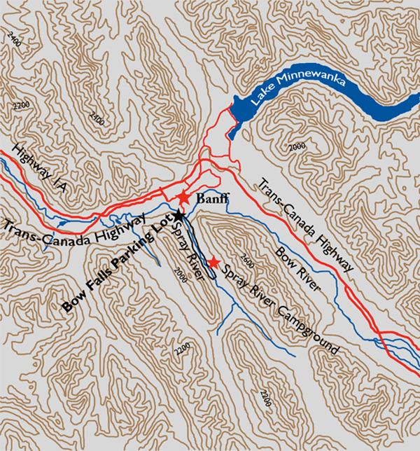
Directions
The parking lot for the trailhead is at the Bow Falls parking lot. From the Banff townsite drive across the Bow River bridge at the south end of Banff Avenue. Turn left onto Spray River Road and drive 750 m to Bow Falls Avenue on the left. Turn down here to the Bow Falls parking lot.