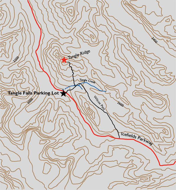
Distance

The trail levels off briefly and begins to descend to meet Tangle Creek. When the path comes close to the creek, begin searching for a faint trail going down to the creekbed. After finding the offshoot path, it is imperative to locate a large, metre-tall cairn up on the bank on the opposite side of the creek. Before crossing, line up Tangle Ridge with the distinctively large cairn and the usually dry gully in which the cairn sits. This gully will take you to the base of Tangle Ridge.
After stone stepping across the creek, search out more cairns farther up the drainage gully. These direct traffic to the right side of the gulch, but trails are faint and not well marked. Nonetheless, pursuing the ditch is easy, and soon enough it enters forest yet again to begin ascending toward the summit. In due course the treeline is attained and the hillside opens up to small pastures on the way to a scree slope. As scree goes, this is not too bad. There is a good trail that seems to have been used extensively, making the usually insufferable scree almost tolerable.
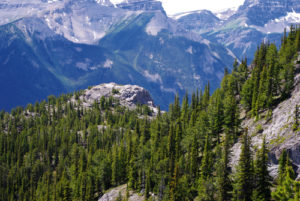
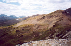
As expected, the sights from the ridge walk are astounding. As you gaze to the southeast, Mount Wilcox and Nigel Peak are visible. Looking northwest down on the Icefields Parkway, you’ll see glaciers, rivers, turquoise lakes and more snow-covered peaks as far away as Jasper. Sunwapta Peak is 8º north, 5.8 km away. This peak stands 3320 m above sea level, putting it at almost 11,000 (10,892) feet high.
History
The name “Tangle” is self-explanatory. It comes from Mary Schäffer in a 1907 reference to the difficulty an exploring party had navigating the creek and surrounding forest. The party was coming down from Wilcox Pass, with the Sunwapta River as their destination. Schäffer had complained that the creek and the valley it is situated in was a tangle of trees, deadfall, scrub and impenetrable undergrowth. Another source says the name is derived from the tangled appearance of nearby Sunwapta River.
Directions
The parking lot for Tangle Falls sits on the west side of the Icefields Parkway 127 km north of the Parkway/Trans-Canada Highway junction, 7 km north of the Columbia Icefield Centre and 103 km south of Jasper. The trailhead is across the highway on the east side, just south of the falls. A sign directing hikers to Wilcox Pass and Wilcox Campground puts scramblers on the correct path.