Distance
The hike up to the lake is scenic, as most of the hike is on a trail on the fairly level, rocky slopes. The trail is indistinct on the talus. As you hike west, stay parallel to the creek. Open rocky slopes allow hikers to enjoy the views of the high peaks, adding visual interest. In two places along the trail, old rockslides have dammed the creek, creating impressive turquoise ponds of glacier-fed water.
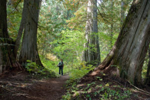
This is a good hike for a casual day outing. It takes about 2.5 hours of easy to moderate hiking to the lake. Avalanche debris blocks the trail in a couple of places. The final half kilometre is very steep, ascending beside the pounding creek in the thick moist forest.

0 km: From parking spot, head downhill on muddy road toward the creek. Follow old road in forest.
400 m: End of bridge is now underwater, but fordable.
600 m: Old road ends at sawdust pile and trail continues southwest, same direction as you were heading.
1.8 km: Trail leaves forest in meadow. Hike downhill (south) toward creek, where water bubbling under rocks at your feet flows under talus at a scenic pond, N27303-E32094. Stay on the south side of the creek for the rest of the hike (creek is on your right as you head west). Intermittent trail in the talus: loose shale, uneven footing; stay low on the slope near the creek.
2.3 km: Second pond. Turquoise glacier-coloured water and the high summits of the Purcell Mountains make this a scenic spot.
3.7 km: Trail leaves grey rock and crosses a strip of beige rock though a rough section formed by a huge landslide. Follow cairns and trail over the mound of the slide. Stay low in the valley just above the main creek.
4.4 km: Trail veers sharply right and slightly downhill to enter the forest beside the fast creek. Grade steepens significantly in the forest. Pull yourself up on rocks and tree roots to gain 61 m (200 ft.) in 0.3 km.
5.3 km: Templeton lakeside with views across the lake to high glaciated summits. The lakeside is a good spot for a picnic, but a campsite may be hard to find in the steeply sloping, thick forest, N26400-E30129, at 1950 m (6,400 ft.).
Directions
Road: high-clearance vehicle; partially overgrown with alders
Follow Bugaboo access roads, from Getting to the Bugaboos to Tiger Pass Road, to Bugaboo Provincial Park. The drive is about two hours from Highway 95 at Brisco. Brisco turnoff is about 26 km north of Radium.

Janice Strong
Janice Strong is an established professional outdoor photographer. Her images grace collections all over the world and appear in many respected publications. She is passionate about hiking and is also an avid snowshoer and skier, exploring the outdoors of the East Kootenay in southeastern BC year round.She openly shares her passion for the outdoors with others and has introduced hundreds of people to the joys of hiking. For a decade she led hikes for the City of Cranbrook – Parks and Recreation. With her guidance, many people have themselves become enthusiastic hikers.
Climbing mountains, finding new places and enjoying the experience of the journey have always been important to Janice. She cherishes the little things she sees along the trail, as well as the grand destinations.
When Janice is not writing, hiking or taking photographs, she is involved in various creative digital, website design or photographic projects for her clients. She and her husband, Jamie Levine, enjoy their rural property, near Cranbrook, BC.