Distance
Towering above the city of Fernie, Three Sisters rises in blocky steps and cliffs, but from the other side the peak slopes up from the valley on an inclined ramp.
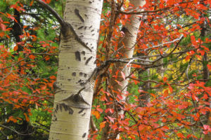
The trail is diverse and interesting even if you are not attempting the summit. Waterfalls, a rain forest ecosystem, the mouth of Bisaro Cave, stunning mountain scenery, and then you get to the climb. The climb is in an open basin, sparsely coated with alpine vegetation spread among ridges and the other Fernie peaks. Especially visible is Mount Bisaro. The route on rock to the summit is not difficult but has moderate exposure. It is a great scenic day hike.
Some hikers can summit Three Sisters in two hours, but most take at least three or four hours. Although the hike is not technical, it is rated moderate/difficult because of the considerable elevation gain, and it is more challenging than other moderate hikes in this book.
The trail to the summit is in a new location on the northern side of the mountain compared to where it was a decade ago. The new trail is much more interesting, a bit longer but with less talus. The old route and new trail merge near the pass. The features along the trail are well-signed. Thank you to the many dedicated volunteers and financial contributors who worked hard to create this fascinating and scenic trail.
Three Sisters Pass is also the first part of the Mountain Lakes trail that connects with Island Lake Resort in an alpine traverse

0 km: Parking spot by trailhead sign for Mountain Lakes Trail. Enter the smooth old road surrounded by dense forest and moss. The trail gradually ascends the rain forest slope of large trees and bright green moss that coats everything.
800 m: “Jumping Waters” is a fabulous thin stream of water that flows in velvety steps down a mossy slope. The next part of the trail is up a steep section for about 150 (500 ft.) of elevation, but the trail switchbacks nicely and is a well-defined trail in the rain forest. Climb on several wooden steps and ladders that are very slippery in wet weather.
1 km: “Watergate” is a spout of water pouring from a karst cave-like hole.
1.5 km: “Bisaro Cave” entrance is a huge hole that penetrates straight into the mountain. The opening is about 6 m (20 ft.) high by 9 m (30 ft.) wide. The trail switchbacks around the cave entrance and climbs almost above the opening. Just above the cave is a ladder fastened to the rock that is a little intimidating when descending, especially when it’s wet.
1.8 km: The trail swings around a wide corner and a sign welcomes you to Bisaro Canyon, but you don’t want to go that way toward Sterling Bridge. But the Bisaro Canyon is worth a look anyway and it’s only 400 m return. The cliffs high above the creek are impressive, especially with mist rising off the damp sides of the deeply gouged-out valley. The bridge is hard to climb onto, as it sits on a sloping boulder and you have to stretch hazardously around to reach the bridge deck. Backtrack a minute or so, near the Bisaro Canyon sign and around that wide corner. Look for a small trail heading left uphill into the bush. Take the small trail and in 200 m come to the junction for Stone Bridge, also worth a look, again 400-m return. The bridge is perched on a round boulder in the middle of the creek.
2 km: If you zoomed by the unnecessary bridge crossings, continue heading south on the even-grade trail in the forest. “Shady Lane” is in a small forested gully. Pass the “ET” sign and gradually gain elevation through a forested highland, where you may encounter old snow even into July. The trail crosses the creek several times before breaking into the subalpine.
4–6 km approx.: The views improve, with the north ridge of Three Sisters rising along the left side, and to the right the trail follows the limestone wall of Mount Bisaro for several kilometres. The grade is less steep, gradually gaining elevation to the pass.
6.6 km: Three Sisters Pass , N93000-E35500, at 2280 m (7,477 ft.). When you reach the pass you have three choices: straight, left or right. Straight ahead leads to the Mountain Lakes trail (see entry #59) and in another three or four hours, Island Lake Resort. This option requires a prearranged vehicle shuttle placed at Island Lake Resort. Or you may turn right and make your way up the shoulder of Mount Bisaro. The third choice is to turn left at the pass and proceed to the summit of Three Sisters. Veer left and make your way directly up a sparsely vegetated shale slope to find a trail skirting below the rocky face of the ridge. Follow this trail to the right. In some places the trail can be loose in scree or indistinct in rocky outcrops, but it generally parallels the ridge to the summit.
8.7 km: The centre peak of the Three Sisters summit, N93000-E37200, is at 2760 m (9,055 ft.) elevation. On the broad summit the hiker will find a thoughtfully situated bench that provides a comfortable lunch spot and an eagle’s eye view of Fernie. A green, strangely shaped communications tower shares the summit. (Upper sections of trail researched by GW.)
Directions
Road: high-clearance 4x4 for final 3 km; muddy; rocky; slick in wet weather
Go Hartley Lake and Dicken Road earlier in this chapter for details of Hartley Lake Road.
0 km: Dicken Road and junction with Hartley Lake Road.
10.6 km: On Hartley Lake Road, at Three Sisters turnoff (7 km sign), turn left (west), N98894-E39167.
13.7 km: End of rough side road ; 4x4 high clearance for this muddy, rocky, rough road, N97100-E37400.

Janice Strong
Janice Strong is an established professional outdoor photographer. Her images grace collections all over the world and appear in many respected publications. She is passionate about hiking and is also an avid snowshoer and skier, exploring the outdoors of the East Kootenay in southeastern BC year round.She openly shares her passion for the outdoors with others and has introduced hundreds of people to the joys of hiking. For a decade she led hikes for the City of Cranbrook – Parks and Recreation. With her guidance, many people have themselves become enthusiastic hikers.
Climbing mountains, finding new places and enjoying the experience of the journey have always been important to Janice. She cherishes the little things she sees along the trail, as well as the grand destinations.
When Janice is not writing, hiking or taking photographs, she is involved in various creative digital, website design or photographic projects for her clients. She and her husband, Jamie Levine, enjoy their rural property, near Cranbrook, BC.