Distance
Top of the World is a remote wilderness provincial park tucked deep in the Rocky Mountains. A wide path leads to Fish Lake at the visitor core of the provincial park. It is a busy place to visit, fish or camp. Fish Lake was named because it’s shaped like a little fish. The blue-grey lake is nestled at the bottom of a deep and steep basin among thick forests of pine, spruce and fir.
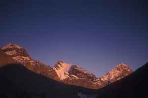
For rugged alpine hiking, many trails head from Fish Lake up into the nearby mountains and the rolling karst plateau. The park’s plateau is about 2100 m (7,000 ft.) in elevation, and Mount Morro, the highest peak in the park, soars to 2912 m (9,553 ft.). For more information, visit www.env.gov.bc.ca/bcparks/explore/parkpgs/top_world/
Trail to Fish Lake: the visitor core of Top of the World Provincial Park
From the parking lot by the Lussier River, head downhill and cross the bridge. The wide graded trail follows the gently flowing Lussier River most of the way. It takes about 2.5 hours of easy hiking to reach the lake in 6.7 km with an elevation gain of 213 m ( 700 ft). A separate trail for horses is across the Lussier River. Once at the lake, enjoy an easy 2-km walk around the lake.
Fish Lake Campsite
Camping is next to Fish Lake with 16 tenting sites with wastewater pits and pit toilets.
Fish Lake Public Cabin – accommodation
A ranger cabin and public overnight cabin are located near the tranquil shore of Fish Lake. The overnight cabin accommodates 20 people and has bunks, tables and a wood stove. Firewood is not supplied. A fee is charged for overnight use, and space in the cabin is first come first served. The park is remote and offers no supplies.
Karst limestone plateau
Karst limestone is a natural feature created when limestone, which is primarily calcium carbonate, is dissolved by slightly acidic water flowing around semi-porous rock. The acidity comes from water seeping across organic materials, such as grassland or forests. The limestone in the park spans large, flat, pavement-like areas, and due to uneven erosion the land is a jumble of irregular slopes and flat terraces. Interwoven sinkholes, underground channels and small cracks braid the limestone. The surface is safe to walk on, as most of the fissures are small. The larger openings are visible in the bare rock surfaces or are evident gaps on the sidehills.
Natural feature
High-volume springs pour out of the ground from underground channels draining the karst plateau above, Crazy Creek and Crazy River. To see these natural springs, hike from Fish Lake and take the upper half of the horse trail back toward the parking lot. A loop trail branches from the horse trail to the springs. About halfway back to the parking lot on the horse trail, remember to cross the Lussier River at Sayles Meadow on a good footbridge. Otherwise, if hikers stay on the horse trail, there is no bridge toward the parking lot.
Coyote Creek Campsite from Fish Lake
Hike toward Fish Lake, and just before reaching the lake, turn left (east) onto the Coyote Creek trail. Sugarloaf Mountain Trail branches left (north) at 5.6 km and it gains another 300 m (984 ft.) Instead of climbing to the summit, turn north (left) for about 500 m to Coyote Creek Campsite. It is a remote wilderness campsite located by Coyote Creek, on the north side of Sugarloaf Mountain.
The campsite is stuck in the forest and is only worth staying at because it is near the karst plateau, which is helpful for those who are planning to exploring the high country of the park’s eastern side.
Karst limestone high plateau from Coyote Creek access
My favourite hiking location in Top of the World Park is away from the visitor core and up into the high limestone areas (not really a plateau, but a stepped mound). The hiking is easy to moderate without a lot of elevation change. The forest is semi-open and easily hikeable. There are several small tarns in the high areas, surrounded by semi-forested and gradually sloping plateau to limestone mountains and ridges.
The routes are unmarked, but with mountain routefinding skills, a topographical map and, if you have one, a GPS, you’ll do fine.
Start the hike to the limestone plateau from either the main visitor core along Lussier Creek, or the more remote access from Coyote Creek Road routes. Exploring the upper elevations makes backpacking up to Coyote Creek Campsite worthwhile.
I prefer to drive Coyote Creek logging road, but it is a bumpy, water-barred, bush road that branches from Lussier Road. (Check the road condition with BC Forest Service before you drive it.) Drive the deactivated Coyote Creek logging road until it ends about 2 km from the park’s northern boundary. Follow the small creek and fragments of trail south, up Coyote Creek to the Sugarloaf Mountain trail. Once at Coyote Creek Campsite, veer off the main trails and head east and southeast up to the high country.
The advantage of this access route is that you don’t have to climb all the way up from Fish Lake. The disadvantage is the unpredictability of the road and the bushwhacking section up Coyote Creek.
Karst Limestone High Plateau from the Fish Lake Visitor Core
From Fish Lake, hike to the Sugarloaf Mountain trail, and instead of climbing Sugarloaf, head east and southeast to the high country.
The advantage of this access is the road is reliable and the trail to Fish Lake is a wide, good-quality trail and the climb to nearly the top of Sugarloaf is also on good trail. The disadvantage is the long climb.
Sugarloaf Mountain
Strenuous hike on a good trail to a rounded knoll overlooking the park’s core. Once at the plateau, however, you can hike for kilometres, exploring the karst limestone of the park’s high country.
Sparkle Lake
Sparkle Lake is the most popular hike from Fish Lake, and the trail is steep in places. The trail climbs west from Fish Lake up the first section of the Wild Horse Ridge trail. The park staff requests that you rockhop rather than cross on the sensitive mosses, which are easily damaged.
Alpine Viewpoint
Another popular hike. The trail begins on the north side of Fish Lake. Follow the trail around the east side of the lake and begin the long rock scramble up a scree slope to the viewpoint. Loose rocks often tumble down the slope and could be dangerous to hikers below, so hike with care. The views from the top of this scree slope make the strenuous hike worthwhile. The alpine plateau over the crest of this rock slide invites further hiking explorations.
Wild Horse Ridge
The Wild Horse Ridge route takes you through alpine meadows with good views. The trail begins at the bottom of a slide just west of Fish Lake, the same trailhead as Sparkle Lake. Bring plenty of water for this steep climb. The route follows along a creek with some rocky bluffs, and ascends a sunny, south-facing slope. From the ridge you can enjoy the grandeur of Mount Doolan and the views of Dolomite Lake to the north.
Summer Pass and Galbraith Creek
Do not bother with these trails. Both are forested trails that are mostly overgrown and they don’t go anywhere. They just peter out in the bush.
Rating: easy
Time: day hike to Fish Lake
Distance: 6.7 km
Elevation gain: 213 m (700 ft.)
Fish Lake: 1768 m (5,800 ft.)
Trail: BC Parks trail, suitable for bicycles and single, chariot-style child carriers; signed and graded with bridges to popular lake in forest; alpine access above
Map: 82G/14 Queen Creek (NAD27)
Trail map
Drive
Road map: Southern Rockies and Top of the World
Road: any vehicle; washboards; dusty in summer; over an hour on gravel roads (from late May to mid-November); Top of the World Park is open for skiing, but check with BC Parks or the BC Forest Service for winter road conditions.
The turnoff for Whiteswan Lake Provincial Park is 5 km south of Canal Flats.
0 km: From Highway 93/95, turn east onto Whiteswan Provincial Park Road.
10.8 km: Continue straight. From here the road is good and wide but bumpy with washboards and descends steeply. A steep drop-off on one side.
17.8 km: Lussier Hot Springs is on the right side of the road (signed). A soothing dip in these hot springs is worth a stop. A 200-m hike on a groomed trail downhill from Whiteswan Road leads you to the brick- and concrete-rimmed outdoor pool with naturally heated water. Outhouses and change rooms are available. Bathing suits are required.
20 km: Turn right at a four-way junction to Top of the World Provincial Park on White/Lussier FS Road. (Straight ahead for Ptarmigan Lake, Whiteswan Lake Provincial Park and White River FS Road. Left fork to Alces/Moose Lake campground in Whiteswan Lake Provincial Park.)
29.6 km: Turn right and cross Coyote Creek.
30.7 km: Continue straight and stay on this road to the 52 km sign.
52 km: Park at the signs for Top of the World Provincial Park.
Coyote Creek Campsite from Fish Lake
Distance: 7 km from trailhead at the parking spot for Top of the World
Elevation gain: 400 m (1,200 ft.)
Sugarloaf Mountain
Distance: 7 km
Elevation gain: 580 m (1,900 ft.)
Sparkle Lake
Distance: 2.8 km
Elevation gain: 350 m (1,148 ft.)
Sparkle Lake: elevation 2134 m (7,000 ft.)
Alpine Viewpoint
Distance: 3.2 km
Elevation gain: 600 m (1,969 ft.)
Wild Horse Ridge
Distance: 3.2 km
Elevation gain: 640 m (2,100 ft.)
Directions
Road: any vehicle; washboards; dusty in summer; over an hour on gravel roads (from late May to mid-November); Top of the World Park is open for skiing, but check with BC Parks or the BC Forest Service for winter road conditions.
The turnoff for Whiteswan Lake Provincial Park is 5 km south of Canal Flats.
0 km: From Highway 93/95, turn east onto Whiteswan Provincial Park Road.
10.8 km: Continue straight. From here the road is good and wide but bumpy with washboards and descends steeply. A steep drop-off on one side.
17.8 km: Lussier Hot Springs is on the right side of the road (signed). A soothing dip in these hot springs is worth a stop. A 200-m hike on a groomed trail downhill from Whiteswan Road leads you to the brick- and concrete-rimmed outdoor pool with naturally heated water. Outhouses and change rooms are available. Bathing suits are required.
20 km: Turn right at a four-way junction to Top of the World Provincial Park on White/Lussier FS Road. (Straight ahead for Ptarmigan Lake, Whiteswan Lake Provincial Park and White River FS Road. Left fork to Alces/Moose Lake campground in Whiteswan Lake Provincial Park.)
29.6 km: Turn right and cross Coyote Creek.
30.7 km: Continue straight and stay on this road to the 52 km sign.
52 km: Park at the signs for Top of the World Provincial Park.

Janice Strong
Janice Strong is an established professional outdoor photographer. Her images grace collections all over the world and appear in many respected publications. She is passionate about hiking and is also an avid snowshoer and skier, exploring the outdoors of the East Kootenay in southeastern BC year round.She openly shares her passion for the outdoors with others and has introduced hundreds of people to the joys of hiking. For a decade she led hikes for the City of Cranbrook – Parks and Recreation. With her guidance, many people have themselves become enthusiastic hikers.
Climbing mountains, finding new places and enjoying the experience of the journey have always been important to Janice. She cherishes the little things she sees along the trail, as well as the grand destinations.
When Janice is not writing, hiking or taking photographs, she is involved in various creative digital, website design or photographic projects for her clients. She and her husband, Jamie Levine, enjoy their rural property, near Cranbrook, BC.


