Distance

The trail into the forest narrows where an old, rough-looking sign guides you to Helmet/Ochre Creek, Tumbling Creek and Helmet Falls campgrounds. A stairway of railway ties assists the entrance into the woods. Within another five minutes, a sign steers you to stay straight on the path and you feel a mild elevation gain. After crossing a couple of small streams, the hike through spruce and pine forest levels off. At about the 3.5-km mark, you come to a magnificent avalanche slope of shrubs, flowers and maybe bears.
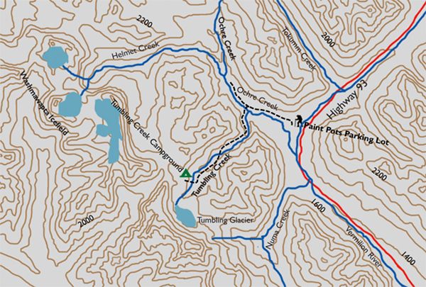
After crossing the slope, you re-enter the forest for another six to eight minutes and eventually come across signs in a small cleared intersection. Turn left to follow the trail another 7.1 km to Tumbling Creek Campground. Six to eight minutes later, the route crosses a suspension bridge, meets the Tumbling/Ochre Junction campground and passes through it quickly. Tumbling Creek sticks to your left flank for a few more minutes until the hike begins to switchback uphill. Ten minutes later the route levels off into a forest of spruce and pine.
The forest takes on an odd characteristic here as it begins to thin out, leaving only the thickest, strongest trees standing. Looking upward through the trees, it becomes apparent that the thinning results from years of bombardment from snow and debris sliding down the mountainside. Here, you can see the forest for the trees.
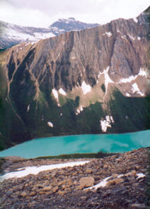
The forest continues to thin and will meet with an expected wide avalanche slope that periodically glances into forest. The journey progresses toward the campground in the midst of trees, shrubs, rocks and soil, meandering up and down through this paradise, and at 6.5 to 7 km into the journey, you cross Tumbling Creek over a short metal bridge. The reason for the name of the creek becomes evident the further upstream you go. This is not a deep, wide, raging river, but a creek that actually falls – tumbles – onto itself. It is steep enough and contains enough rock and debris that it truly does tumble rapidly down the valley.
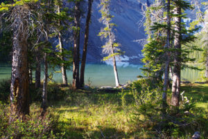
Continue briefly uphill, to be rewarded with uncluttered views of the green, open slopes on both sides of the creek. Drainage down the slopes into Tumbling Creek is spectacular. An added bonus is the sight of Grey Mountain directly down the trail to the southwest. A couple of waterfalls in Tumbling Creek simply add to a magnificent day. Combine this with a bit of elevation gain within the forest and some stretches of creekside rambling and the day will soon be complete at Tumbling Creek Campground.
Directions
Follow the Banff–Windermere Highway (Hwy. 93) 19.6 km south from Castle Junction to the Paint Pots parking lot on the west side of the highway. The trailhead is on the west side of the parking lot.
The route leaves the parking lot into a beautiful forest of Engelmann spruce and lodgepole pine. The path is well trodden and usually well populated for the first ten minutes, as this route to the Paint Pots is quite popular with roadside trekkers. Throughout your journeys, you will discover the same theme: many roadside attractions are littered with tourists who will look at you with bewilderment as you walk past them in full backpacking gear. They have no idea of what you are doing, where you could possibly be going or why you would do it.
A straight, level path affords wheelchair access within the first minute. Both routes descend gently to the Vermilion River to cross a short suspension bridge. At this position, the 360° panoramas are astounding. Peaks of the Vermilion Range dominate the west and northwest horizon,while the Ball Range towers over the span of the eastern sky. If you can stop looking around long enough, follow the trail along the stream and into the forest to arrive at the lower Paint Pots. This should take no longer than ten minutes.

Gerry Shea
“Gerry Shea moved to Kamloops from Vancouver at the age of nine, which is when he became enchanted by the nearby hills. It was on a family vacation many years later that he discovered the mountains and began hiking and climbing in his spare time, gathering knowledge and experience that he has since used to help beginning hikers, scramblers and backpackers to trek safely. Gerry lives in Kamloops with his wife and children.”Excerpt From: Gerry Shea. “The Aspiring Hiker’s Guide 2: Mountain Treks in British Columbia.” iBooks.