Distance

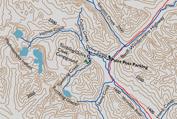
Head back into the pine and spruce forest at the far edge of the slope, but before you do this, stop and look around. Have a gaze up the hillside and down toward the creek below. Try to imagine the force of rushing, crashing snow that could mow down a forest, removing all evidence of sturdy trees, leaving brush, shrubs and flowers to flourish in their stead. Now, back into the forest, you will encounter a small intersection within six to eight minutes. There are a few signs and directions here, so pay close attention to ensure you take the correct path. Turn left at the junction and follow this path for 400 m. Cross Ochre Creek on a suspension bridge to a very primitive campground on the riverbank. Tent pads dot the shoreline and there’s a privy along a trail into the forest. The place does not appear to have any bear poles.
Directions
The route leaves from the Paint Pots parking lot, located 19.6 km south from the intersection of the Banff–Windermere Highway (Hwy. 93) and the Trans-Canada Highway at Castle Junction. The parking lot is directly off the west side of the highway, and the trailhead is at the west side of the lot.
The trail immediately enters the forest. As soon as the trek begins, the route splits, becoming wheelchair accessible down the left fork, a unique quality for any backcountry route. The two branches rejoin shortly after, just in time to cross the Vermilion River over a short suspension bridge. The bridge and the banks on both sides provide spectacular sights in all directions. On the eastern horizon is the Ball Range, while the west and northwest skies give you the Vermilion Range. Continue the path to the lower Paint Pots.
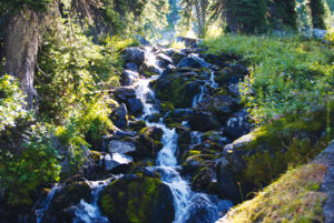
The muddy path carves through wide open lower flats of the Paint Pots for a few minutes and then inclines slightly to gain the upper area of the Paint Pots and ochre beds. The track fades here and you can either make your way around the muck and moisture by detouring to the right or simply barge directly across the small mudflat. Either way, it is a short inconvenience before reaching the sign that picks up the trail again. Before you cross, though, stop and check out the springs exiting the ground beneath your feet. There is so much iron oxide in these cold mineral springs that it forms cone-shaped structures that rise in height from the constant deposit of minerals at the base of the cone.

Gerry Shea
“Gerry Shea moved to Kamloops from Vancouver at the age of nine, which is when he became enchanted by the nearby hills. It was on a family vacation many years later that he discovered the mountains and began hiking and climbing in his spare time, gathering knowledge and experience that he has since used to help beginning hikers, scramblers and backpackers to trek safely. Gerry lives in Kamloops with his wife and children.”Excerpt From: Gerry Shea. “The Aspiring Hiker’s Guide 2: Mountain Treks in British Columbia.” iBooks.