Distance

The falls are on the left (west) side of a smooth trail that cuts through the campground. At the far end, you reach another signed intersection guiding you to take the right fork to continue to Twin Falls Campground 2.5 km farther on. The remainder of the route is an enjoyable walk beside Twin Falls Creek with negligible change in altitude.
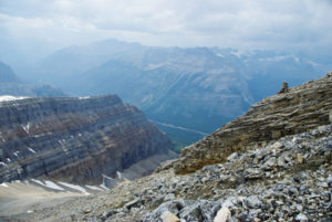
Shortly after departing Laughing Falls Campground, the path crosses Twin Falls Creek, landing on the eastern bank. The spruce and pine forest is thick, but it occasionally permits partial glimpses of the dual falls. Infrequently, gorgeous hemlocks also populate the Twin Creek Valley. Continue uninterrupted through forest paralleling the creek until you reach the Yoho Glacier junction at the 6.4-km mark. The way is obvious, as the glacier trail branches to the right and the campground sits a short descent down the left fork.
The campground has eight sites, a bear pole and a couple of outhouses. A central cooking area is difficult to locate, but it is there. However, if you are not in the mood for cooking, get back on the trail and climb about 200 m within 1.5 km. If you were not hungry before setting out, you certainly will be when you reach the chalet.
The falls drop 180 m after being split into two cascades by a limestone block. The two falling-water chutes merge just before they land in a narrow chasm. This is an utterly glorious waterfall. The sound, sight and feel of this natural wonder will fill your body with joy. Occasionally, during low glacial runoff seasons, the left passage would become blocked. The recourse was to blast the waterway with dynamite. This was not a permanent solution, however, as I witnessed the single-drop spectacle first-hand in 2003. At first we felt cheated, but soon realized we were being treated to a rare event.
Twin Falls history
A Canadian Pacific Railway crew cut the trail to these falls in 1901 as part of an ongoing drive to develop the Rocky Mountains for tourism. As the popularity of the falls grew, the CPR built the tea house to feed and house guests who had ventured in to see this spectacular site.
The first phase of the teahouse was constructed in 1908 as a single-storey cabin for overnight backcountry touring. In 1915, more effort was directed toward trail construction and the path was greatly augmented. It is this same route that we hike today. The upgrade inspired more visitors and the CPR found itself turning overnight guests away. So eventually, in 1923, the railway leased this idyllic half-acre setting from the National Parks Branch, instituting “Twin Falls Rest,” named, of course, for the extraordinary Twin Falls cascade. Construction of an additional storey to the teahouse began in 1922 and was finished in 1924. From 1925 to 1928, the first and second phases were joined together by a simple, single-storey connection.
Directions
Drive 3.7 km east on the Trans-Canada Highway from the Yoho National Park Information Centre and turn left onto Yoho Valley Road. Follow this road for 13 km to the Takakkaw Falls parking area. The Yoho Valley Trail starts at the far end of the parking lot. The hike begins by taking you to Takakkaw Falls Campground, situated 400 m from the parking lot. Just beyond is the Yoho Valley trailhead.

Gerry Shea
“Gerry Shea moved to Kamloops from Vancouver at the age of nine, which is when he became enchanted by the nearby hills. It was on a family vacation many years later that he discovered the mountains and began hiking and climbing in his spare time, gathering knowledge and experience that he has since used to help beginning hikers, scramblers and backpackers to trek safely. Gerry lives in Kamloops with his wife and children.”Excerpt From: Gerry Shea. “The Aspiring Hiker’s Guide 2: Mountain Treks in British Columbia.” iBooks.