Distance

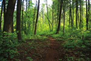
So, pass through the wood beam gate and parallel the peaceful waters of a creek that has two concurrent names: Hiuihill and Bear. The official toponym is Hiuihill Creek, but I think the Bear name likely got adopted because it’s easier to pronounce, or maybe someone saw a bear in the creek at some point.
Seven to eight minutes into the hike, the path crosses the creek on an unstable bridge, the only significantly difficult part of the trek. The route begins to climb out of the narrow valley at the other side of the bridge. Switchbacks are the most dominant and conspicuous characteristic for the next 10 to 15 minutes. During this ascent, keep an eye out for Bear Creek Falls on the left side of the trail.
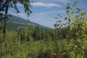
The switchbacks finally peak just over 1 km, or 15–20 minutes, into the hike. A sign reading UPPER TRAIL greets you at the summit of the climb. The sign has a single arrow pointing between the left and right fork – take the left fork. Look behind you to see a panorama of Tsalkom Mountain. Because the creek has a sudden drop in elevation at the falls, you are once again strolling alongside the creek. The creek is crossed a couple more times shortly after leaving the summit.
Roughly 2 km (30 minutes) from the trailhead, you encounter an intersection with two signs. Both have directional arrows pointing both left and right. One sign says TRAILHEAD, the other, LOOP TRAIL. Choose the right-hand, LOOP TRAIL path.
Five minutes later another junction presents another two signs, each with two bidirectional arrows: LOOP BACK TO TRAILHEAD and LOOP TO TOP OF TRAIL. Follow the latter sign, which is the right-hand fork.
In another five minutes you will arrive at a sign reading END OF TRAIL. This is actually not the end of the trail, but the far end of the upper loop. Here is where a few relics of the flumes remain. Moss-covered beams litter the forest here, and looking down the forest of scattered timbers you can see a clear path that appears to travel for several hundred metres.
The trail continues to loop, and five minutes from END OF TRAIL it meets another junction, this one with a sign saying LOOP BACK TO TRAILHEAD. Take the right-hand path. You have now hiked approximately 3 km. If you choose the left fork, it will take you to a maintained display consisting of a shortened replica of flume near a section of the original structure. As mentioned, the bridge is closed, so you will be required to backtrack, adding approximately 2 km to your day.
The remainder of the journey is obvious. Follow the signs to the trailhead, returning by the same way you came, and you will find your way back to the parking lot in another half hour, for a total of 5 km.
Directions
From Chase, travel east on the Trans-Canada Highway for 10 km until you reach the turnoff to the North Shuswap region. This right-hand turnoff takes you onto the Squilax–Anglemont road. From the Squilax bridge, crossing the Little River, drive the Squilax–Anglemont road for 3 km to Holding Rd. and turn left. Carry on along Holding Rd. for 5 km and again turn left into the Upper Flume Trail parking lot on the left side of the road.