Distance

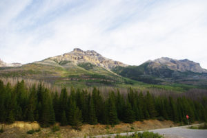
Just beyond this junction is a distinct marker sending you to Yoho Lake and Takkakaw Falls. The falls are 10.5 km away, the lake 6.4 km. This is a rather unusual path for the Canadian Rockies, as it is flat and straight for a little over a kilometre, seeming more like a seismic line than a trail.The route travels across an alluvial fan formed by braided streams that have deposited rocks, trees and silt. An alluvial fan typically forms where water from a canyon or gorge enters a flat plain. As the pressure of the flow diminishes, the water slows and spreads across the plain, depositing the silt, trees and rocks it was carrying through the canyon. The gorge in question is evident as you look to the left and follow the source of the alluvial fan. An extensive array of boardwalks traverses the many streams of the fan. Even so, there are some minor rockhops and stream jumping, depending on the extent of runoff during the season.
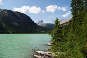
At the end of the flats, the hike begins its climb toward Yoho Pass. As you approach the switchbacks in the openness of the fan, you get a better perspective of the journey ahead. The degree of the incline becomes evident, as you are faced with nowhere to go but up and over the pass. The switchbacks, as usual, are steep and steady with only a few breaks of level terrain. Look back behind you to see an amazing scene consisting of the alluvial fan, Emerald Lake, mountains of the Van Horne Range and the trail on the flats.
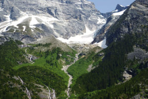
Twenty minutes of climbing brings the route alongside a short, wide waterfall that is close enough to the path that you can feel its spray. On a hot summer day the spray and nearby shade provide a cool, refreshing reprieve. Just a few metres uphill from the falls, the path flattens as it approaches a slope of rubble about a kilometre long. The hike re-enters the forest at the far end of the slope and will ascend another 201 m to the crest of Yoho Pass. From the pass it’s only a minor descent of 750 m to the lake.
Directions
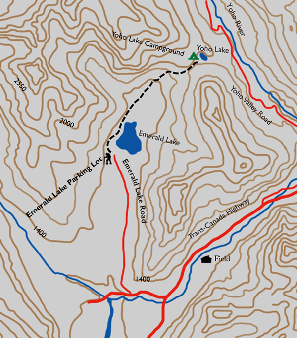
Emerald Lake Road is 1.6 km west of the Yoho Information Centre in Field. Turn right onto the road and follow it for 9 km until you reach the Emerald Lake Lodge parking lot.

Gerry Shea
“Gerry Shea moved to Kamloops from Vancouver at the age of nine, which is when he became enchanted by the nearby hills. It was on a family vacation many years later that he discovered the mountains and began hiking and climbing in his spare time, gathering knowledge and experience that he has since used to help beginning hikers, scramblers and backpackers to trek safely. Gerry lives in Kamloops with his wife and children.”Excerpt From: Gerry Shea. “The Aspiring Hiker’s Guide 2: Mountain Treks in British Columbia.” iBooks.